Francesca and Henk-Jan's Backpacking Trip!
Tuesday, October 13, 2009
Journey to the Center of the Earth! (Well, not quite, but it was very red and very, very hot!)
Hi everyone!
Henk and I just finished a crazy active adventure in Central Australia. The last time that Henk visited Australia, he only really saw the East Coast of Australia. We both wanted to make sure that this time, Central and Western Australia would not be forgotten. Therefore, after Cairns, our next destinations were Uluru (Ayers Rock) and Perth. Remember, Australia is around the size of the United States, so this is quite a bit of ground to cover!
Most people who travel to Uluru do so by flying into Alice Springs, and then doing a round-trip tour from Alice Springs to Uluru and then back to Alice Springs. However, Henk and I realized right before our trip that we were flying into Uluru itself! We didn’t think that would pose much of a problem – sounds like less hassle and driving, right? Not so quick… the ONLY hostel to stay at in Uluru was a YHA at $200 AUD a night for a double room! Complete rip off, because they have a total monopoly on the place. Our only other options were hotels and resorts, and we didn’t want to spend our money that way.
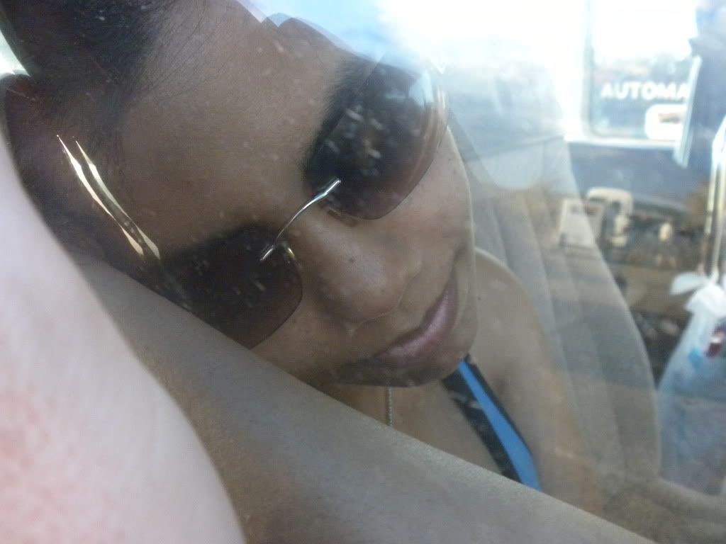
At the tour agency, I booked us into the only tour that would leave from Uluru, and end in Uluru. It was a 2 day, 2 night tour – and if we flew into Uluru the morning of the tour, and flew out the afternoon the tour ended, would enable us to not have to stay a single night in an overpriced hostel or hotel. (But we wouldn’t have much time to relax… that is for sure.) We decided this was the best option considering the costs, and on the morning of Saturday, the 10th of October, we flew into Uluru. That morning’s flight was pretty OK, because we got to watch the latest episode of Heroes on the plane.
Our plane landed, and we grabbed the free shuttle to our pick-up point for the tour: Ayers Rock Resort. Something important about Uluru – the entire little town there is run by an American travel agency called Voyagers; the schools, the security, the maintenance, everything! (And actually, it is even up for sale. Anyone want to buy a resort city in the middle of the Outback?) Anyways, we were dropped off at the resort and after rushing to re-pack our bags, (we stored our larger backpacks with the resort and only brought a daypack for the 2 days with us) we split a gourmet burger at the resort restaurant.
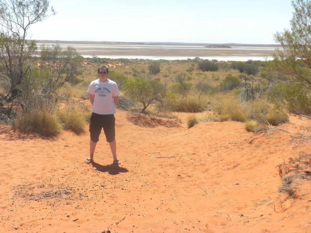
Around 1 pm, we were picked up by Ben from Adventure Tours. However, we weren’t going to be with Ben for long. The only stop we had with him was a look-out point… an extremely dangerous one! Henk and I got out of the bus and walked up a sand dune to look out at a dried up salt lake. I know what you’re thinking—suuuuper interesting. The real challenge was trying to walk on the VERY hot sand with just our sandals on. I never realized sand could get so hot! Henk thinks the sand was more than 120 degrees F. (45 C) It was so painful on my feet, that I jumped on Henk’s back and got a piggyback ride the whole way down the sand dune! (Pays to have such a strong boyfriend. :P)
On the drive towards our meeting point with our “real” tour group (the first bus we were on was only a transport bus for us, since our tour bus was running quite late) at what is probably one of the only gas stations in the whole state, a place named Erldunda. Henk guarded our bags outside while I ran in to the extremely overpriced convenience store (Come on, $6.00 for a prepackaged ice-cream cone?) and bought us two of the cheaper ice-creams they had to help cool us off. Although it wasn’t humid, the dry heat was killer! The temperature was over 100 degrees F (35 degrees C) … pretty rough. Finally our tour bus arrived, and once our driver Lisa finished fueling up, we took off on our Uluru adventure!
Let me tell you all a little background about Uluru, and explain exactly why we were even in Central Australia. Uluru is listed as a World Heritage Site. The original owners of Uluru are the local Aboriginal Australians called the Anangu, and although the rock was taken from them by the Europeans, it was given back in 1985 and thus renamed from Ayers Rock to the Aboriginal name of Uluru. The name Uluru doesn’t actually mean anything in their language, but is a local family name. It came to be known as Ayers Rock when surveyor William Gosse visited in 1873 and named it such in honor of the then-Chief Secretary of South Australia, Sir Henry Ayers.
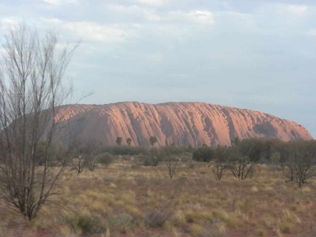
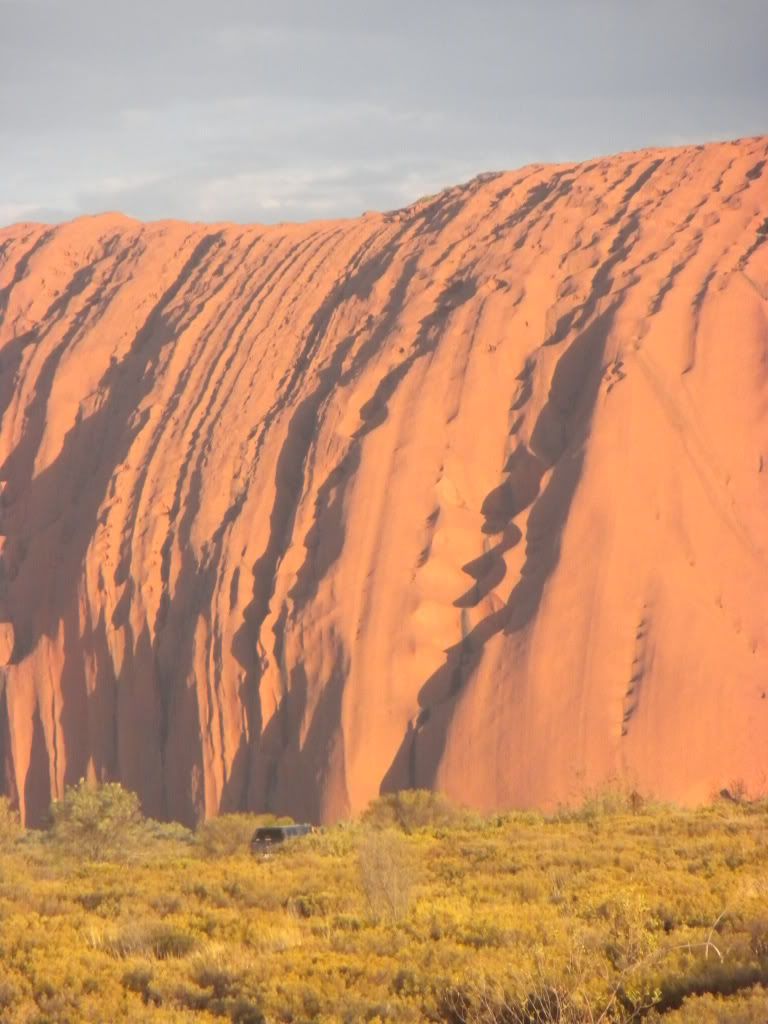
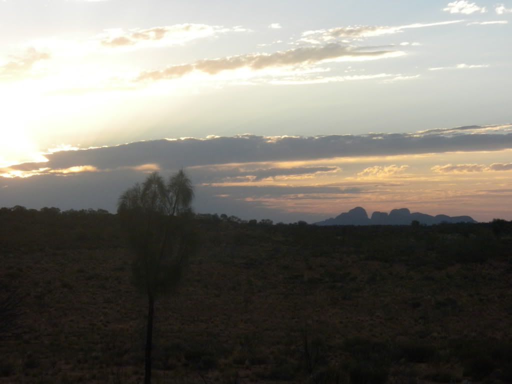
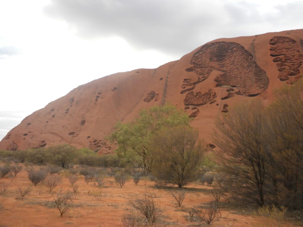
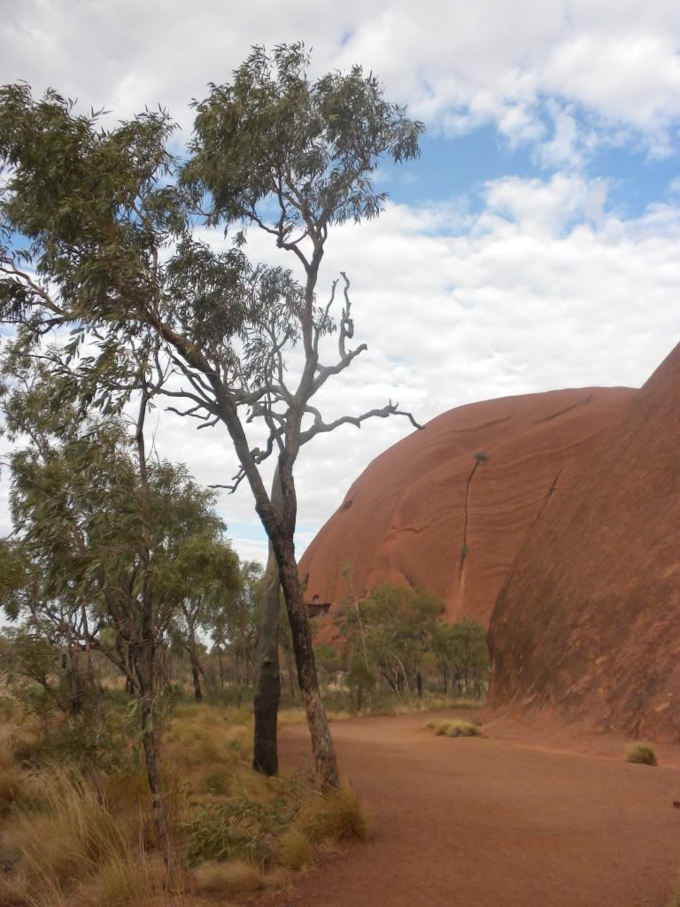
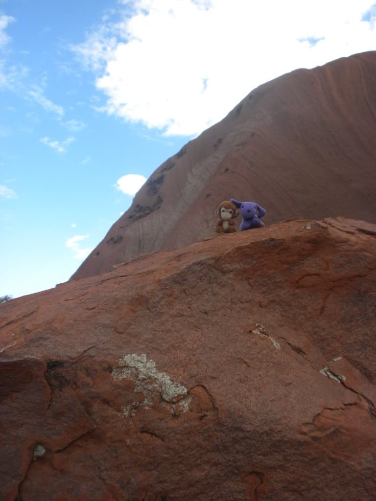
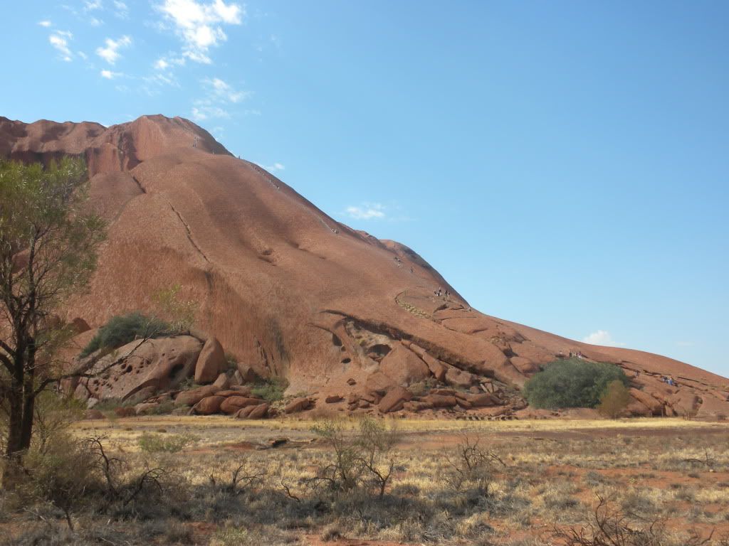
Our first glimpse of Uluru was actually on the drive towards the resort. I looked out the window and spotted it immediately. You couldn’t miss it! It was massive! One glance and you instantly understand that you’re looking at something spectacular. 348 meters above the surrounding plain (according to a sign we found at the Tourist Information Center at the resort) and over 5 kilometers underground Uluru has a base 9.4 kilometers around and an area of 3.33 square kilometers.
There are two main “ideas” of beliefs about the creation of Uluru and the surrounding rock formations, one mythological and one scientific. Henk and I didn’t hear the Aboriginal story about Uluru until almost the end of our trip, but I’ll relay it for you now. According to the Aboriginals:
There were two boys playing in the mud after rain during the creation period. When they had finished their game they travelled south to Wiputa… Fighting together, the two boys made their way to the table-topped Mount Conner, on top of which their bodies are preserved as boulders.
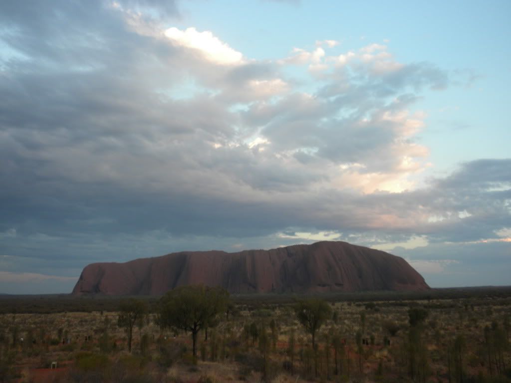
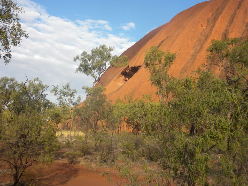
According to Wikipedia and the Scientific Community: Uluru is an inselberg, literally “island mountain”, an isolated remnant left after the slow erosion of an original mountain range. The sacred rock is famous for its changing color with the sun: When the sun is low in the sky at sunrise and sunset, the red end of the spectrum is most dominant. This makes the clouds red. When this red light reflects off the red oxide stained rocks of Uluru, the red color is enhanced further. Sounds pretty cool, huh? But we weren’t going to see Uluru right away – we had two other awesome rock formations in the area to explore first.
But before that, we had to get to camp for the night. While we were driving towards our camp, Lisa told us an interesting story about the highway we were on: Lasseter Highway was named after Richard Lasseter, a man who claimed he found gold in the region. Unfortunately, he was not able to get the exact coordinates, but he did have a crudely drawn map. He eventually got enough people together and went looking for his gold. After a few days of being sent all over the place, his party realized they weren’t going to find the gold and left Lasseter behind. Lasseter went out on his own to find his gold, but was weakened by dehydration and taken in by the Aboriginals who found him. They attempted to care for him, but he stayed weak, and when the Aboriginals had to leave they told him where water could be found and left him behind. Lasseter thought he was healthy enough to walk back to Alice Springs (300 kilometers away) but died on his way back. The gold spoken of by Lasseter was never found, but some people are still looking today! (Many of course think he was lying about the gold the whole time.)
Lisa also had a few “games” to help pass the time in addition to her stories and music playlists. One of them was a “Who can eat one Weetbix the fastest” challenge – Weetbix, being disgustingly dry without liquid, is terrible to choke down. I tried, but couldn’t get it down before 2 minutes. Henk won the game, as well as beating the travel company’s top record, by swallowing it down in 56.33 seconds! His prize was to be “King of the Camp” for the evening, meaning he didn’t have to do any clean-up and got to wear a crown. However, I ended up with the crown for most of the night…
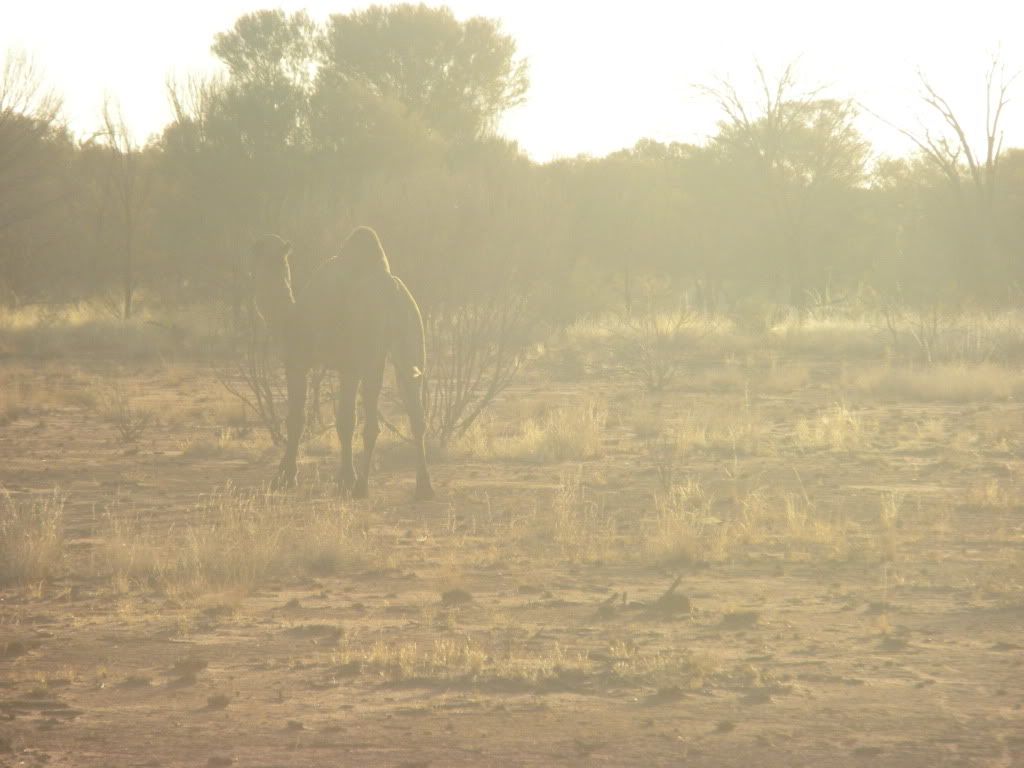
Our second “game” was trying to spot some wildlife. This is much harder than you think in a place with so little vegetation! We did end up seeing a black camel and some kangaroos! (And a lot of road-kill kangaroos as well.) Later at camp that night during dinner (sadly of spaghetti Bolognese; I was expecting some Bushtucker grub!) we caught a glimpse of a few more creatures: a scorpion scurried under our table during dinner and right before that a giant (baseball sized) moth-like cricket flew under the table and got itself tangled in a spider web – but not before landing on my skirt!
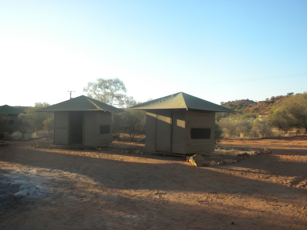
During dinner, Lisa asked us if we wanted to see a demonstration of how to use a “swag.” We had the choice that evening of sleeping out under the stars in a swag or sleeping in our mildly better tents with wooden beds that we needed to roll out our sleeping bags on. The swag was invented by a German backpacker in Australia, and is basically a rolled-up mattress inside a sleeping bag. Lisa unrolled the swag and explained a little about the history. Since I was so freaked out already by the creepy crawly wildlife around, I was confident a swag was not the way to go. Plus dingos commonly approach swags during the night searching for food! That’s not the way I want to see a dingo…
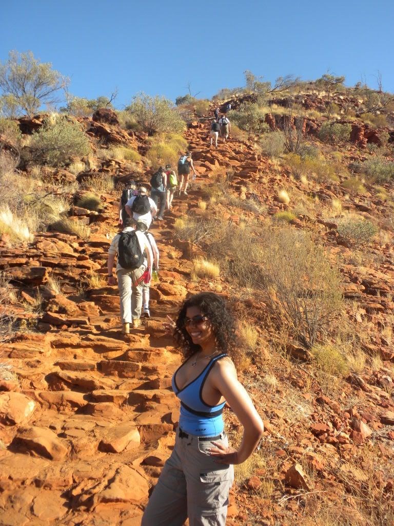
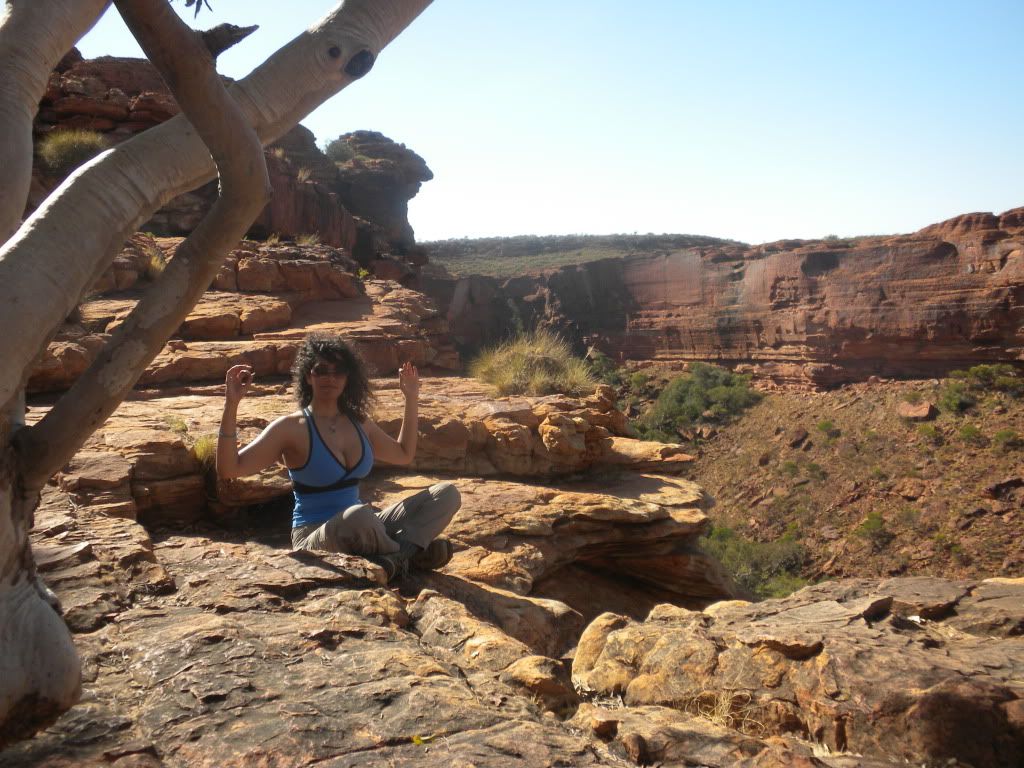
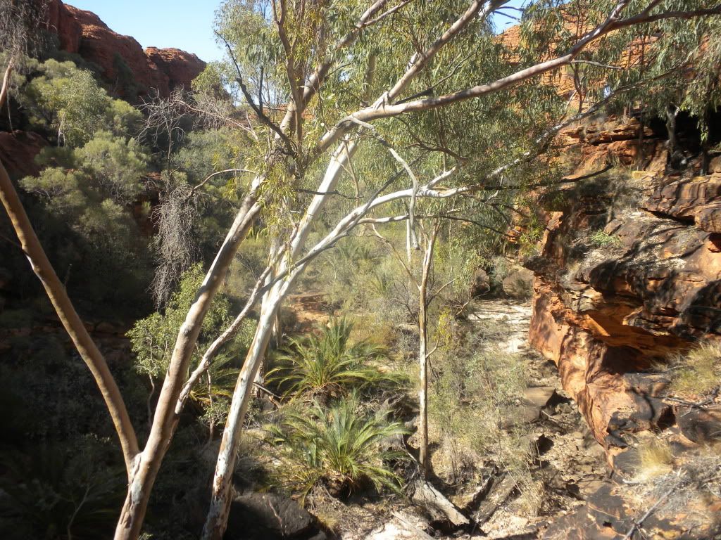
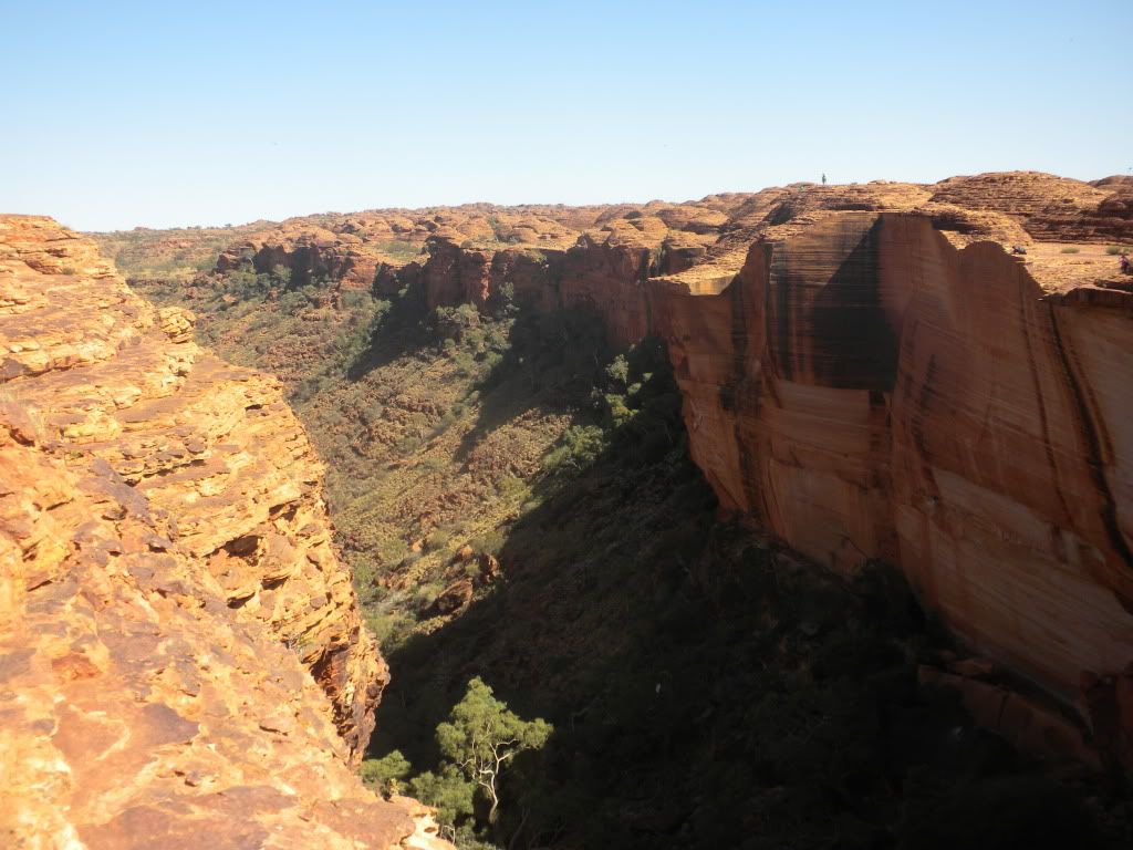
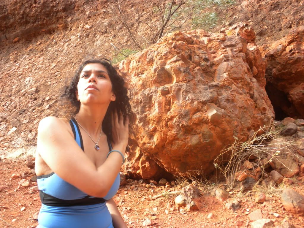
The morning of October 11th was an early rise to go hiking on Kings Canyon! This day was extra special for Henk and I; it also marked our 1 year anniversary. That is right! “Subchisikms” is now 1 year old! Because of the timing, we didn’t really have a choice when we did our Uluru tour and we resolved to celebrate our anniversary when we got to Perth instead. (A tent in the sweltering outback is not extremely romantic, but seeing the phenomenal Kings Canyon that day together was an amazing experience to remember our anniversary by!)
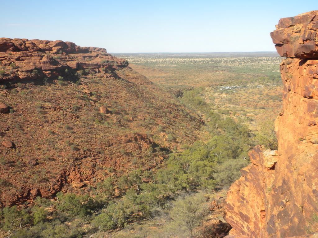
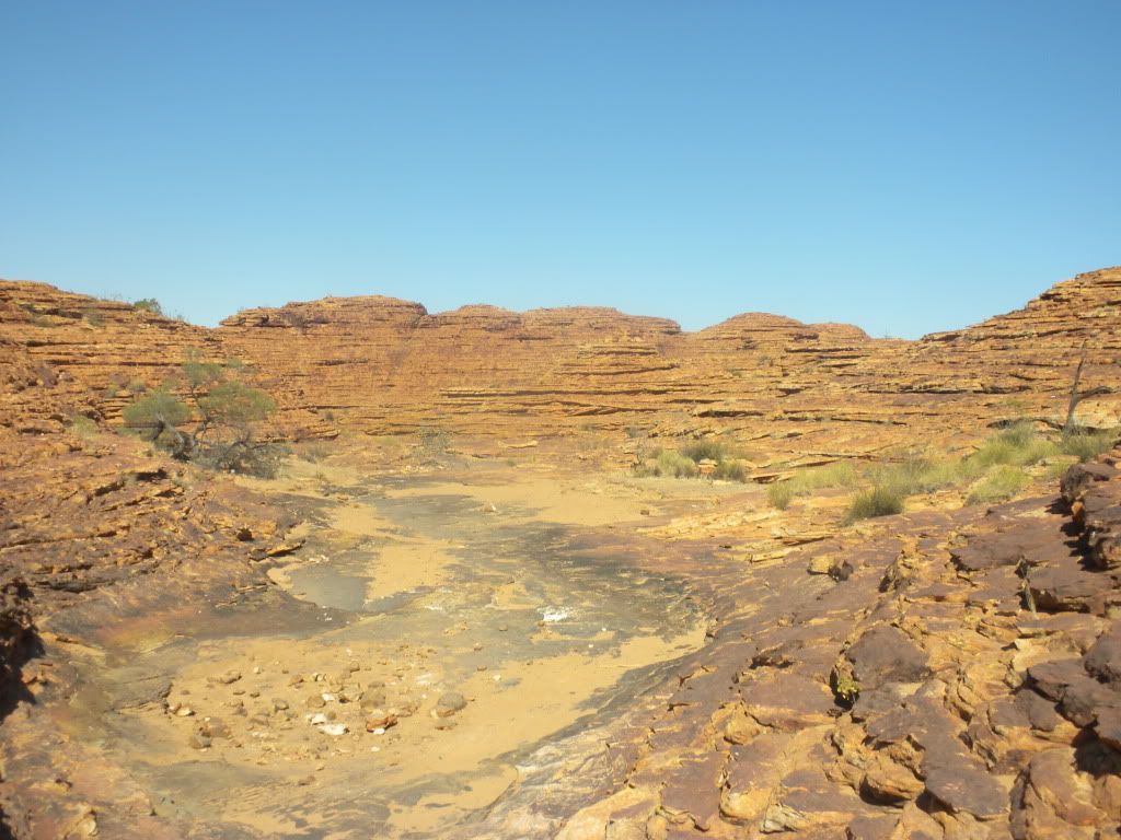
Hiking has never been my favorite thing in the world, but I’ve gained much more stamina by tackle the challenge so much in New Zealand. Plus, with views like we were going to get, I knew it would be worth it. Kings Canyon has a 6 km loop path we walk on, which takes about 3.5 hours. The walls are over 300 meters high, with Kings Creek at the bottom. This is not the world’s easiest walk! I was reminded of Tongariro Crossing as I stood at the beginning in front of the 100 meters of sandstone steps known as “Heart Attack Hill.”
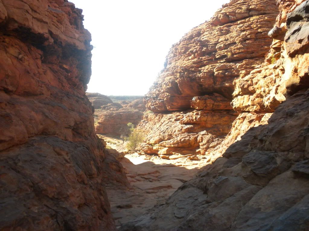
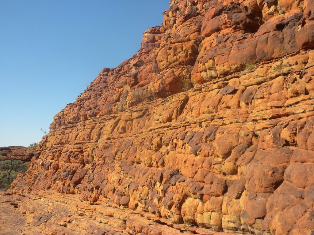
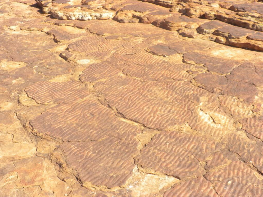
Once we reached the top, we learned a bit more from Lisa about the sandstone we were walking on. First of all, the sandstone is over 440 million years old and makes up the majority of Kings Canyon! Kings Canyon formed over millions of years of wind and rain eroding away at a crack in the center of a large plain of sandstone. On the cliff tops, the sandstone is hard and brittle because it is made almost entirely of quartz grains, cemented with silica. The sandstone on the slopes of the canyon is more crumbly because it contains softer minerals mixed with quartz. As we walked a bit further, Lisa stopped again to point out ripples in the sandstone ground. Evidence there used to be shallow lakes in the area!
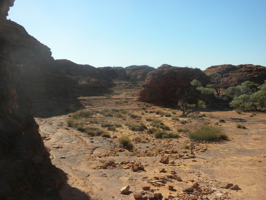
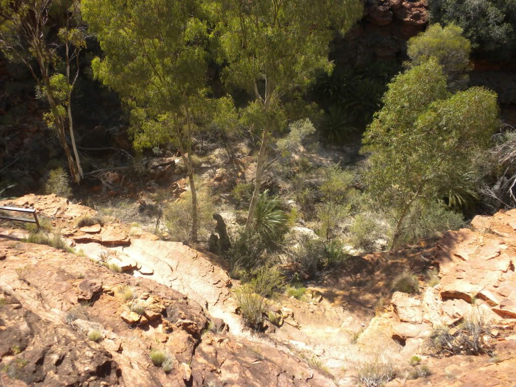
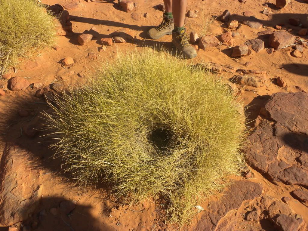
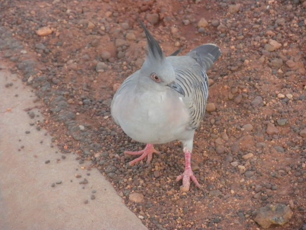
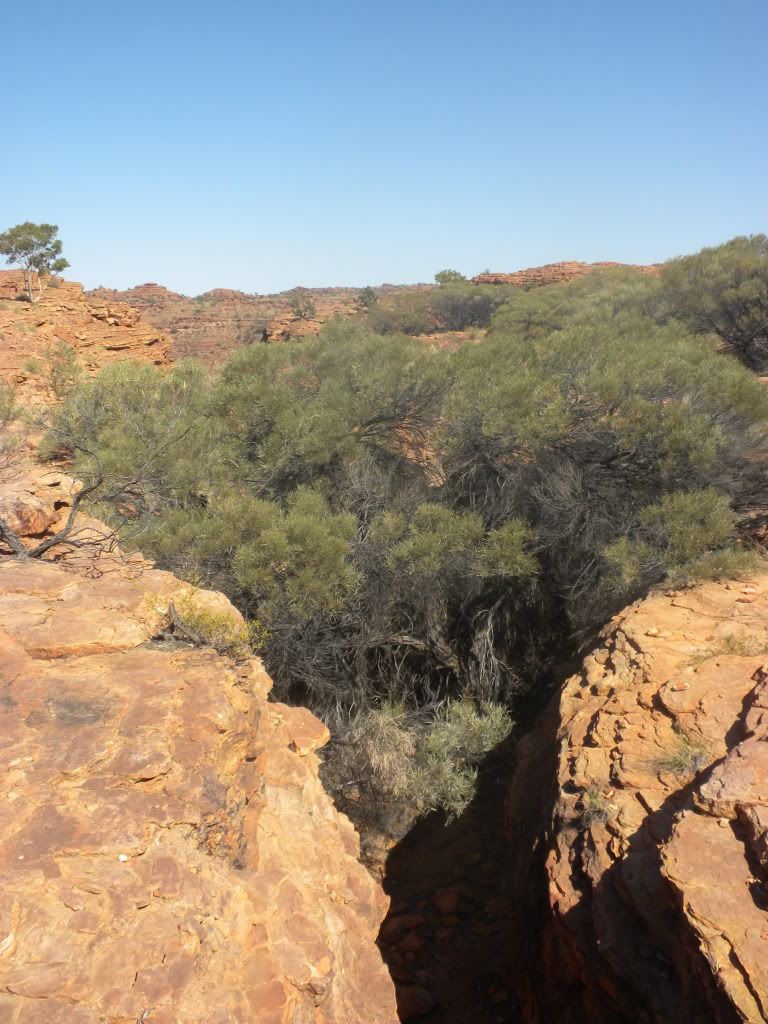
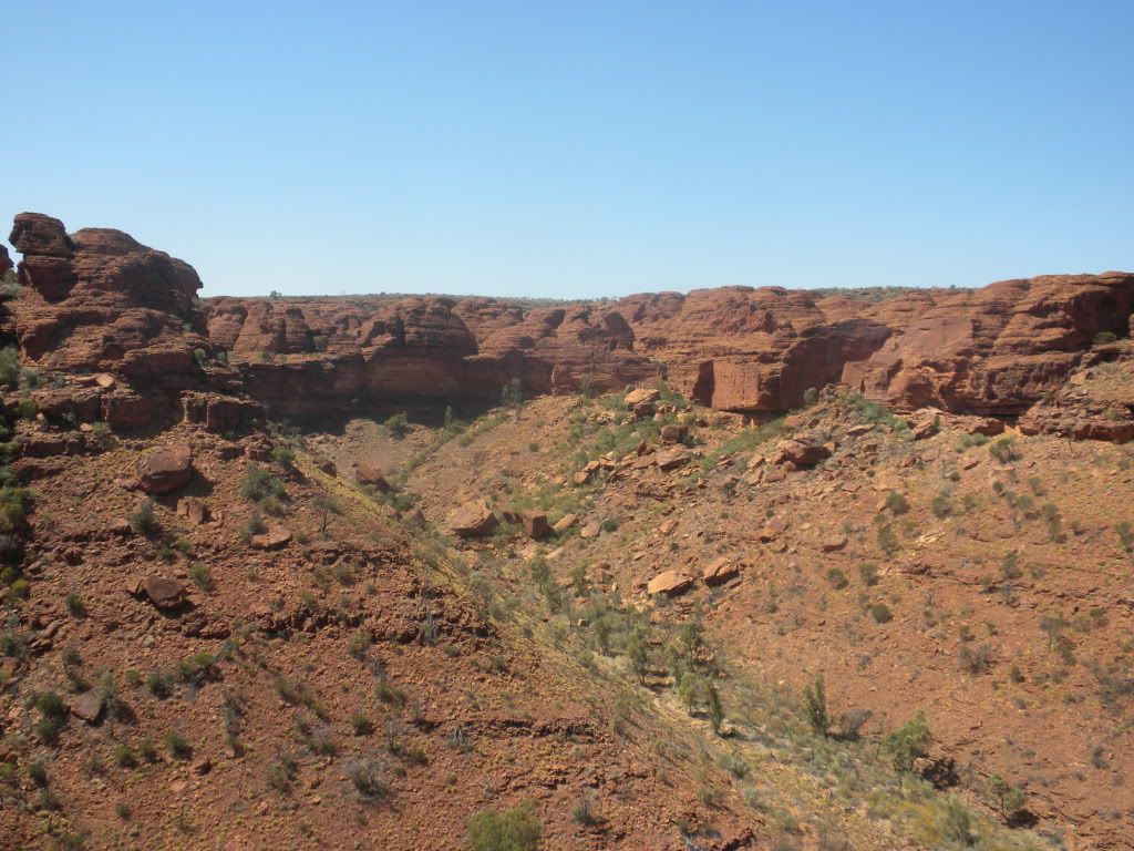
About halfway through our walk, we reached the Garden of Eden – a lush green area in the middle of mostly dry nothingness. Kings Creek feeds the area with water, keeping it flourishing and making it the home of most of the wildlife in the area. One of the creatures we learned about is the spinifex pigeon. These funny looking birds make their nests out of very sharp grass known as spinifex. Despite their nests being on the ground, the prickly material makes it difficult for predators to get at their eggs. The Aboriginals had their own use for the spinifex, I believe making a sort-of pancake out of it.
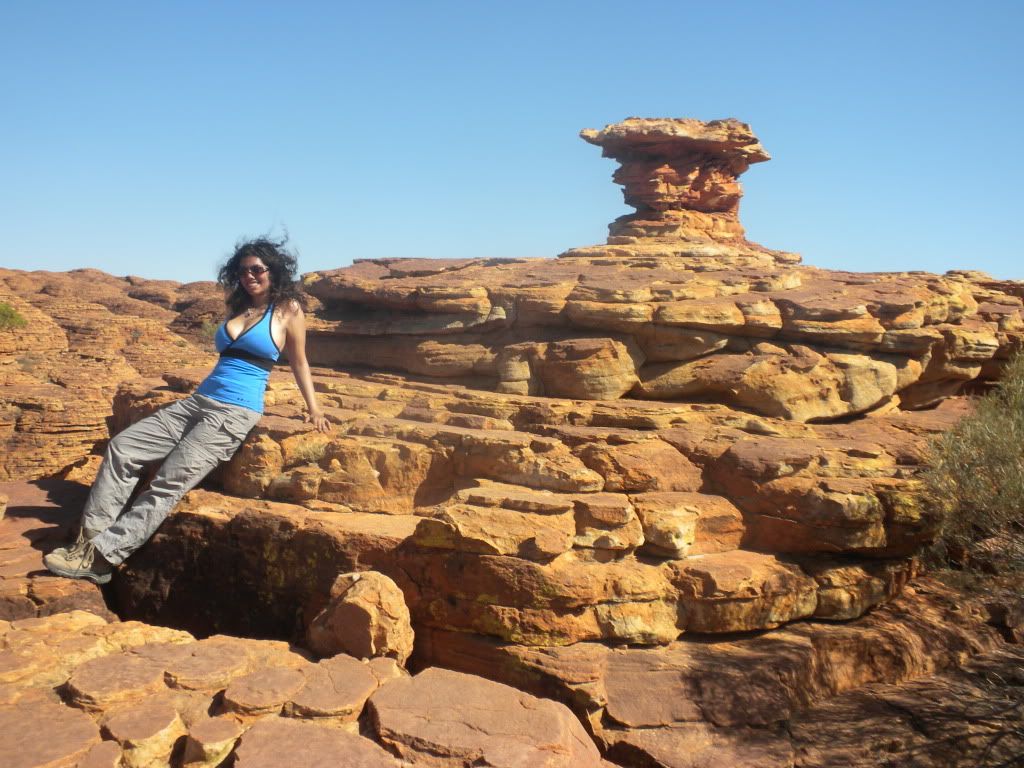
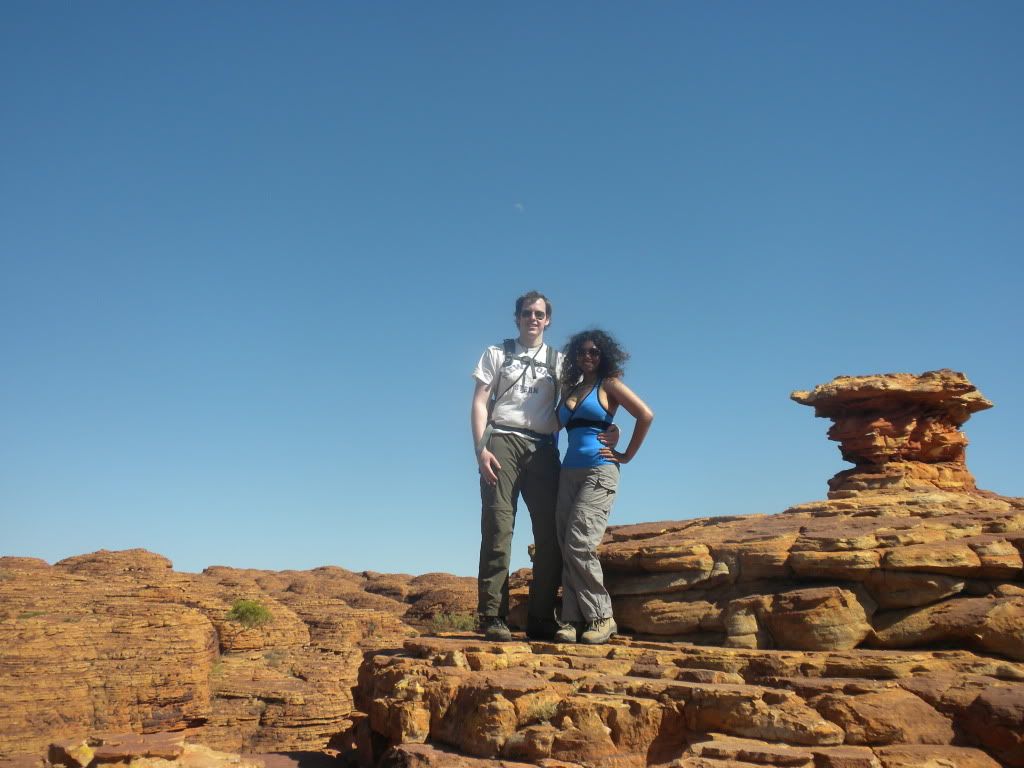
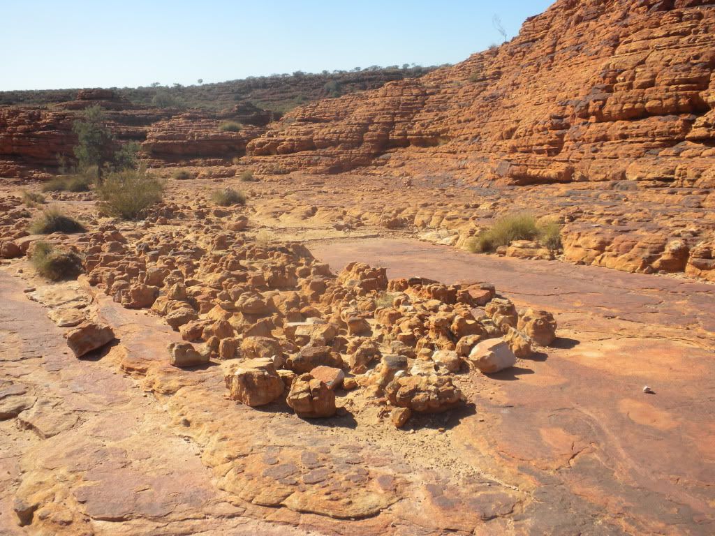
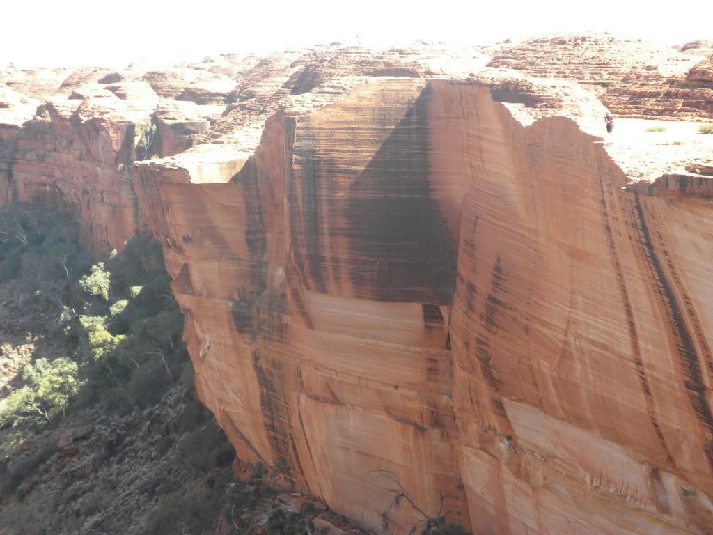
Towards the end of our morning walk we came across the sandstone domes. Formed out of another sandstone block, wind and rain weathered the areas between intersecting cracks in the stone over 20 million years-- resulting in giant rounded beehive-like structures. We also noticed areas of stone which seemed to be striped. Turns out, the dark coloration is formed when rainwater runs down through the rock, soaking up the iron oxide. It then trickles down the cliff face, leaving behind a long rusty iron stain. Furthermore, green and black algae actually manage to grow and survive on the cliff face, making it even darker in places. Rain is not common on Kings Canyon, but when the area does have heavy rain, some cliffs such as Kestrel Falls become amazing waterfalls! Sadly, it didn’t rain while we were there.
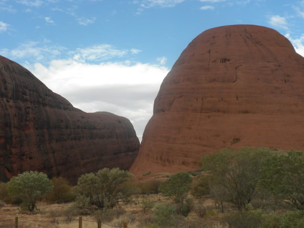
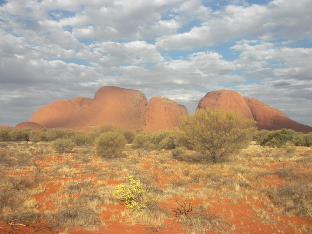
Sweating and overheated, we made it back to the bus to rest on another long drive. We stopped along the way to eat our sandwiches and fruit for lunch, but we couldn’t rest for too long. That afternoon, we had an appointment with the Aboriginal Sacred site of Kata Tjuta. Kata Tjuta, also called Mount Olga or the Olgas, is another rock formation of giant domes about 25 km (16 miles) west of Uluru, from the same underground mountain range as Uluru. Kata Tjuta means “many heads,” and it is as sacred to the Indigenous people as Uluru.
Since the Aboriginals keep the details of their sacred stories secret, we don’t know too much about the area, except that they use it as a “Men’s Scared Site” for certain rituals. Wikipedia gave us a little more info, telling us that a number of legends surround the great snake Wanambi who is said to live on the summit of Kata Tjuta and only comes down during the dry season. We also learned that many ceremonies are still carried out here at night. One of these former ceremonies included a type of public punishment that in extreme cases included death. That’s about all the information there is; the Aboriginals are extremely tight-lipped with outsiders!
Kata Tjuta looked so strange! I had never seen nature that looked like this before… it was almost like walking on Mars, minus the bits of vegetation around. We could see huge boulders on the ground around us, and looking up to the gaping holes in the rock face, it’s pretty obvious where they came from. It was a nice, easy walk at Kata Tjuta and we returned from the furthest point we were allowed to go in less than an hour. Comforting break after all the hiking this morning!
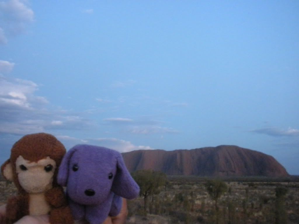
That evening we drove to Uluru for a sunset viewing. Henk attempted to get some pictures of Uluru sitting on top of my back, but I’m not quite sure those turned out as well as he hoped. Since it was cloudy, Uluru wasn’t glowing as red as we were promised – didn’t make for the greatest pictures, so we mostly enjoyed the crackers, cheese spreads, and champagne offered to us by the tour company and took pictures of Kata Tjuta in the distance instead. We were driven to camp, an almost identical camp to our previous night’s camp, and Lisa cooked up some chicken stir-fry and fruit custard for dinner.
Our wake-up call the next morning was before 5 am for an Uluru sunrise. However, it was still cloudy from the night before and raining a little bit. We were grateful we saw the rock in its full red-sand splendor the morning we flew in, because a cloudy sunrise was just about as anti-climatic as a cloudy sunset! That didn’t matter much to us though, we were just eager to go see the rock up close. At this point we had a choice to make: climb, or not climb Uluru?
Wiki explains why this was an important decision: “The local Anangu do not climb Uluru because of its great spiritual significance. They request that visitors do not climb the rock, partly due to the path crossing a sacred traditional Dreamtime track, and also due to a sense of responsibility for the safety of visitors to their land. The Anangu believe they have a spiritual connection to Uluru, and feel great sadness when a person dies (flogging themselves) or is injured whilst climbing… 35 people died since 1985 and many more before that trying to climb Uluru.”
Yikes! That’s a lot of things weighing the “not climb” choice. After all, it is basically akin to an Aboriginal “Mecca” or a high Cathedral. However, because of the rain that morning, the climb was closed at the time we were supposed to make a decision. But I highly doubt (especially after seeing the climb later in the day) the combined risk of death and disrespect to the Anangu would have been worth climbing Uluru. Lisa drove our group to the start of the Uluru base walk, and we got our cameras ready for some close photos of strange rock formations and ancient Aboriginal rock art. But we were told to wait!
Lisa explained that we were only allowed to take pictures in the areas which were not marked as an “Aboriginal Sacred Site” by a sign in front of them. These “no photography” areas are the sites of gender-linked rituals, and are forbidden ground for Anangu of the opposite sex of those participating in the rituals in question— they are not even allowed to look at each other’s sites! Lisa told us that an Aboriginal man was reading an article in a magazine when he went to the dentist one morning on Uluru, and ended up seeing a picture of one of the Women’s Sacred Uluru sites. This incident caused great uproar in the Aboriginal community, and led to the photography ban of sacred sites.
Tourists however, are okay to check out the sacred sites (regardless of gender) from a distance, since they are considered visitors by the local Aboriginals. We are seen as children and therefore we can still visit all these cool spots. Henk and I also found out that this is the reason we were not able to find much information about their myths and legends. The only stories we are allowed to hear, and that have been shared with non-Aboriginals are stories told to educate children. Much of the lore has been kept secret, and will most probably never be shared. Perhaps for the better…
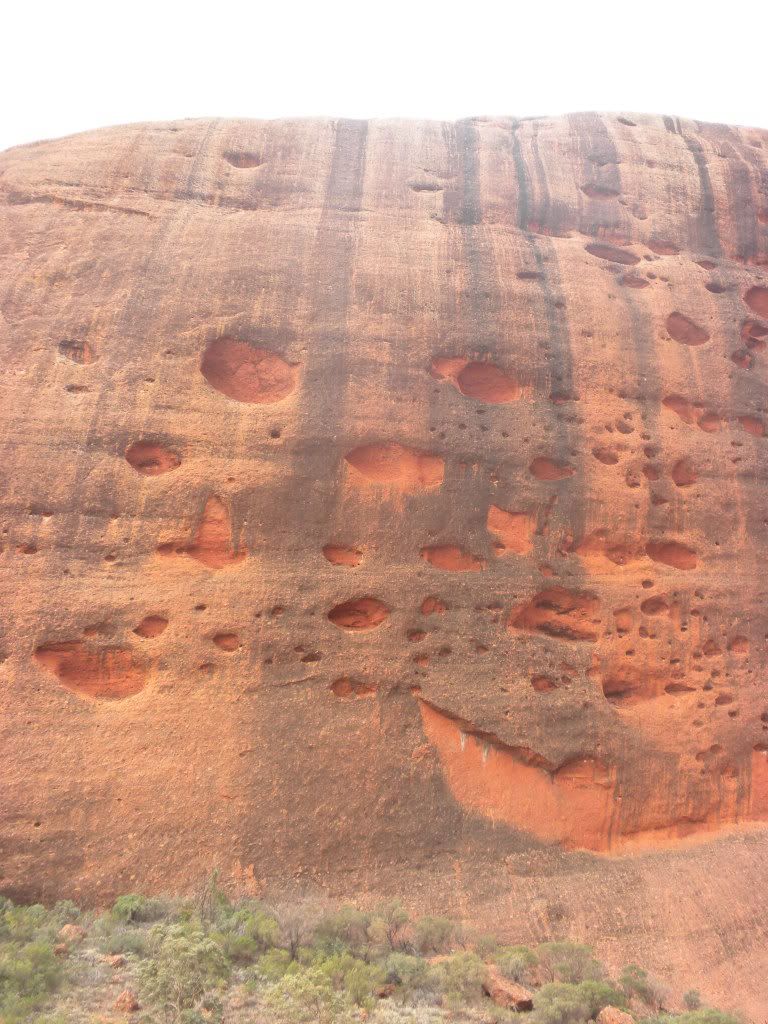
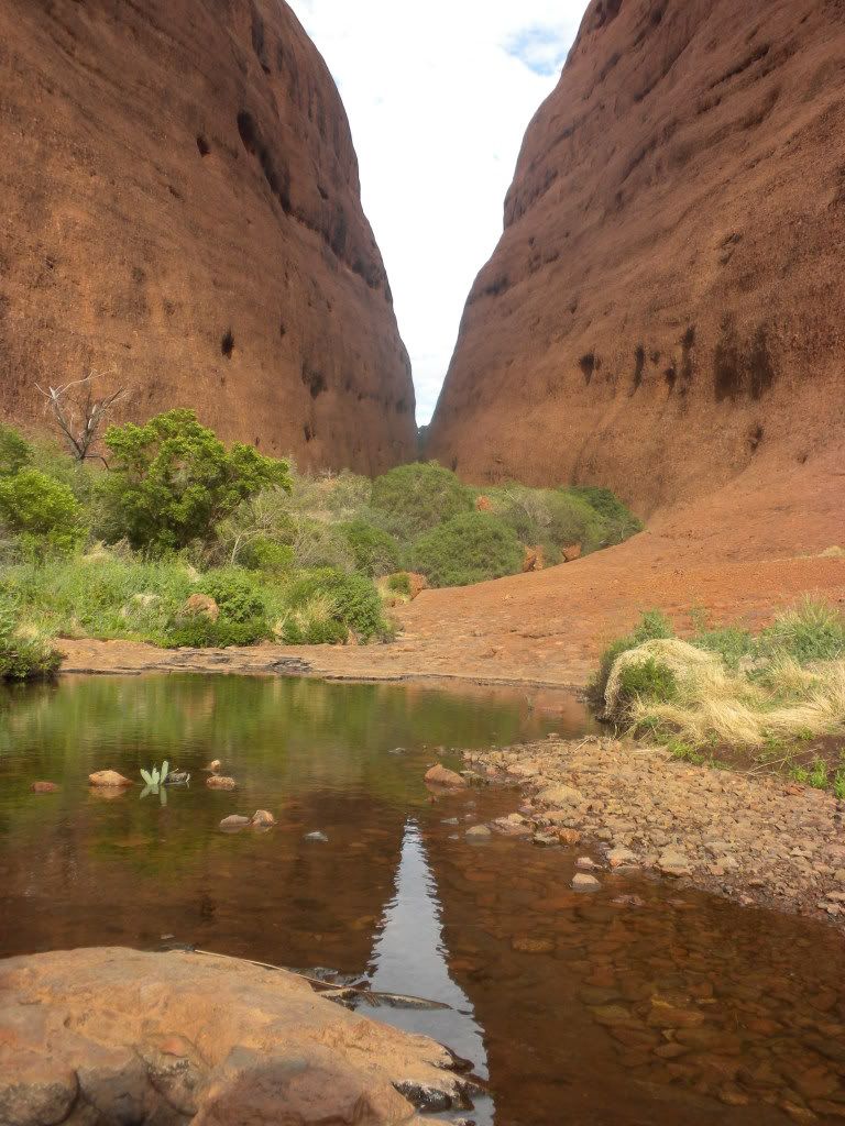
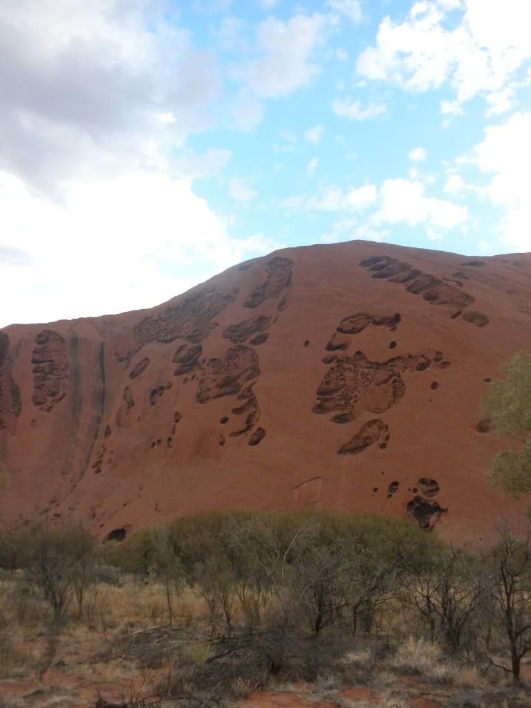
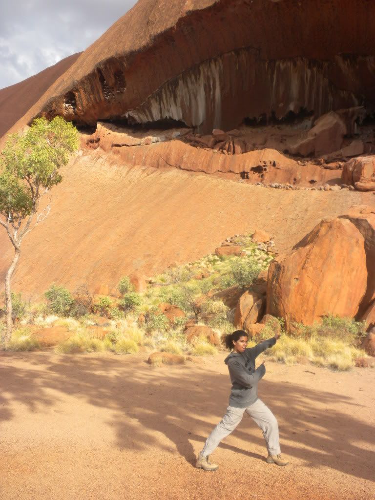
Henk and I took our time walking along the base of Uluru, admiring the formations. Some of them were huge! The shapes were obviously exceptional and unusual, and it is not puzzling that the Anangu could find special meanings and stories in them. One of those stories that we were allowed to hear was a children’s story of an Aboriginal woman:
The Kuniya woman came from far away in the east to hatch her children at Uluru. She carried her eggs strung around her neck like a necklace and brought them to rest at Kuniya Pita (one of the sacred sites at Uluru) on Uluru’s north-east corner. There she left the eggs on the ground. Kuniya camped at Taputji and hunted in the nearby sandhills. As she left and entered her camp she formed deep grooves into the rock. These grooves are still there. One day Kuniya had to draw on all her physical and magical powers to avenge the death of her young nephew, also a Kuniya and sometimes called Kuniyawati. He enraged a group of Liru, or poisonous snakes, who traveled from the south-west to take revenge on him. The Liru saw him resting at the base of Uluru and rushed upon him, hurling their spears. Many spears hit the rock face with such force that they pierced it, leaving a series of round holes which are still obvious on the west side of Uluru. The poor Kuniyawati, outnumbered, dodged what he could but eventually fell dead.
When the news of the young python’s dead reached his aunt on the other side of Uluru, she was overcome with grief and anger. She raced along the curves of the rock to Mutitjulu waterhole, where she confronted one of the Liru warriors, who mocked her grief and rage. Kuniya began a dance of immense power and magic. As she moved towards the Liru warrior she scooped up sand and rubbed it over her body. Her rage was so great that it spread like a poison, saturating the area at the time. In a fearsome dance, Kuniya took up her wana, or digging stick, and struck the head of the Liru hard enough to draw blood in a ‘sorry cut’ of the kind that Anangu still use in times of mourning and grief. But her anger was now beyond restraint, and she hit him again across the head. He fell dead, dropping his shield near the so-called hunter’s cave. Signs of this terrible conflict are still on the rocks around Mutitjulu waterhole. Kuniya herself remains a sinuous black line on the eastern wall. The blows she struck are two deep cracks on the western wall. The Liru’s shield lies where it fell, now a large boulder.
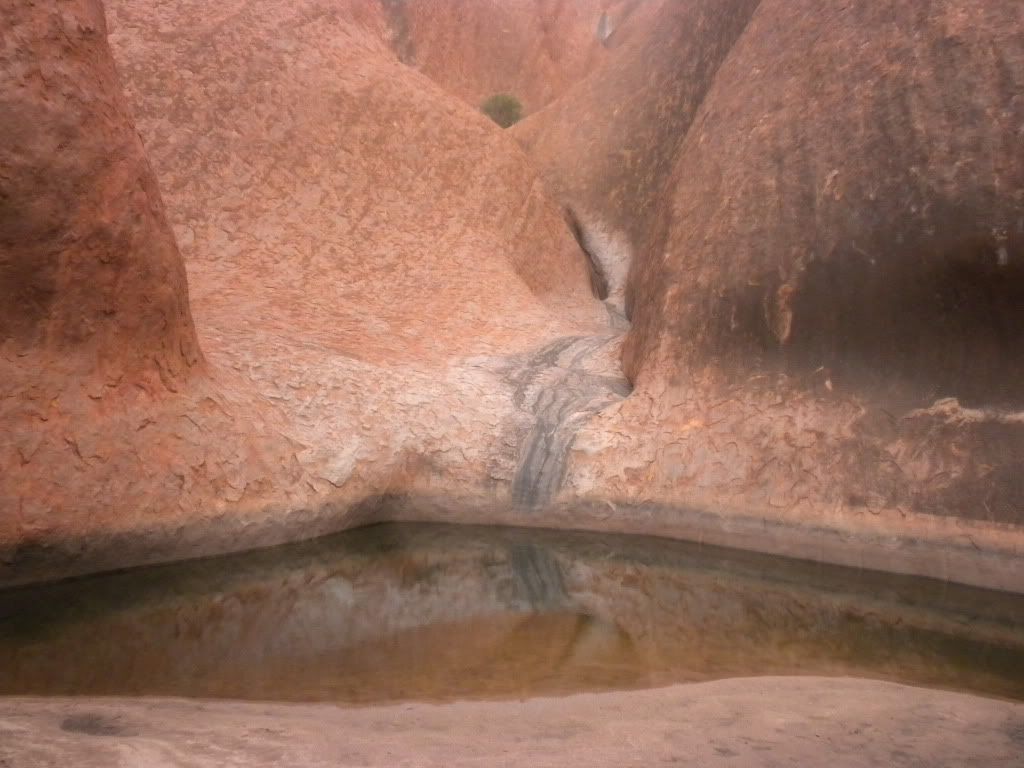
Henk and I continued walking until about halfway around the base of Uluru until we reached the sacred water hole from the story above. Remember the great ancestral snake Wanampi who lived on Kata Tjuta? The Mutitjulu waterhole is another home on that snake.
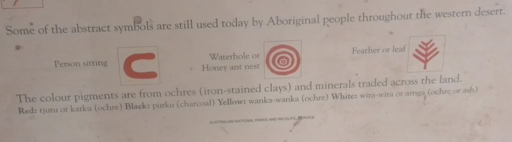
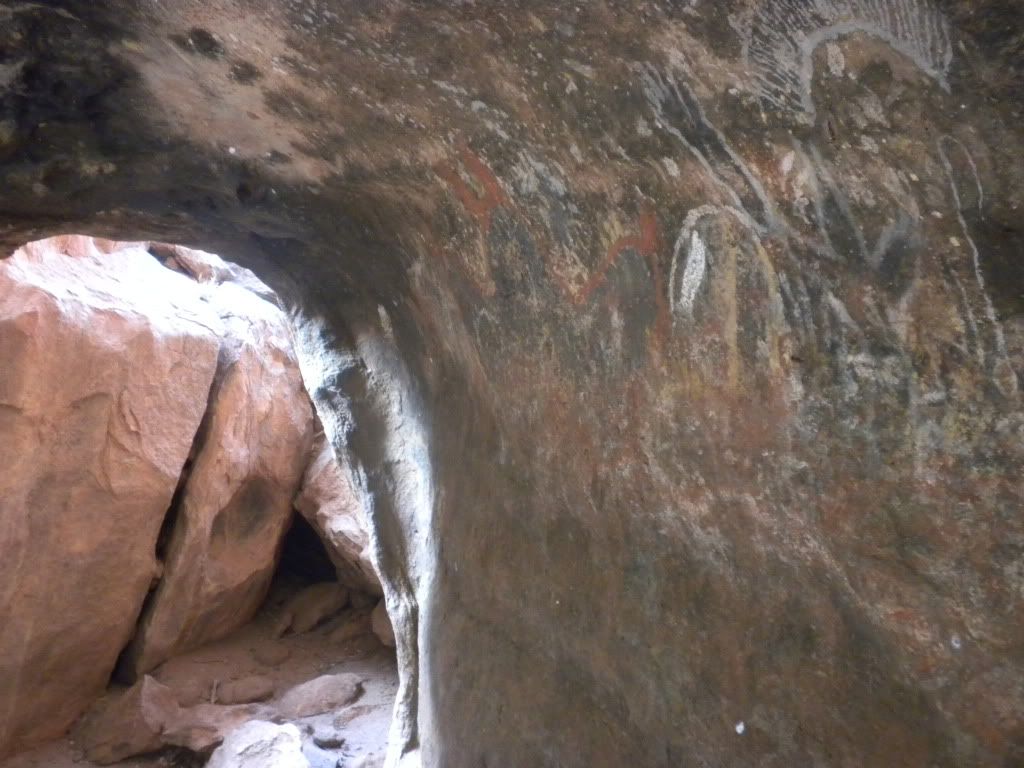
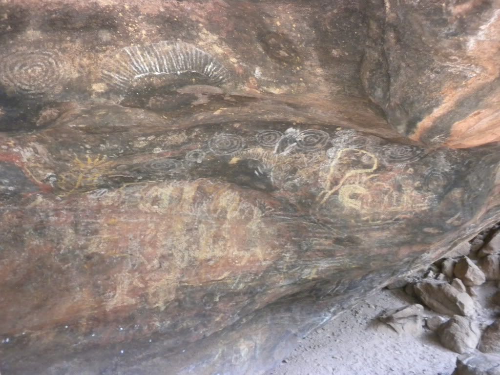
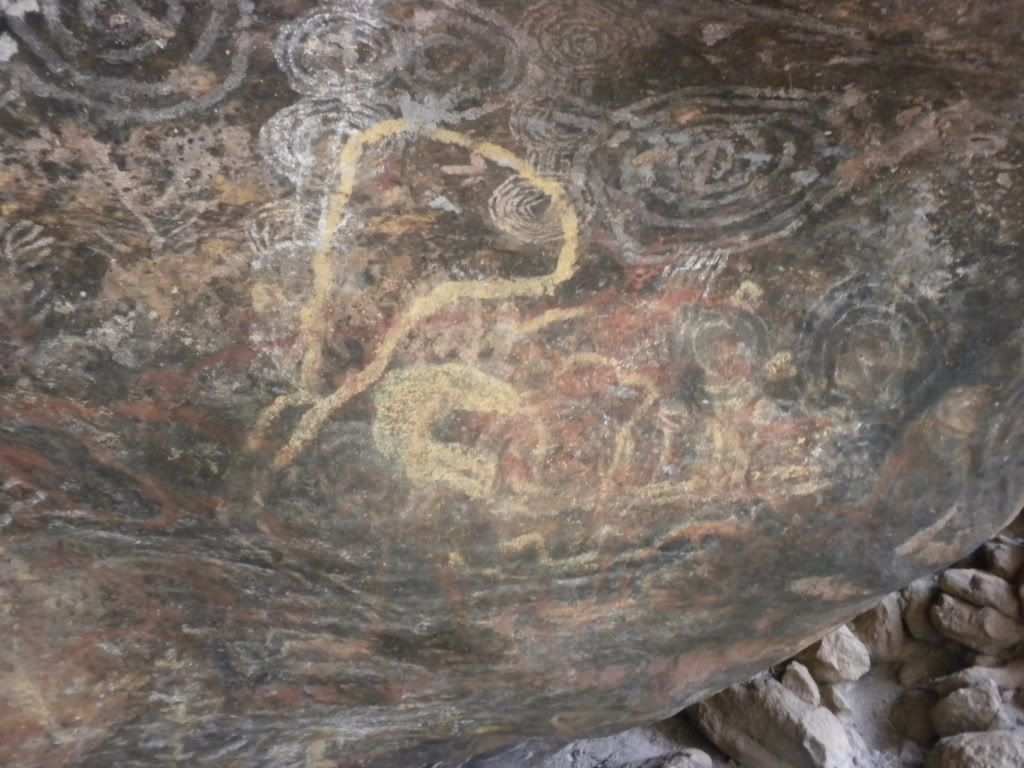
Around the corner from the waterhole was the first display of Aboriginal rock art – art that was tens of thousands of years old. And we were allowed to take pictures! Awesome. Aboriginals used the rocks not really as painting palette, but more like a message board. They left information for each other about water holes, food, and other resources on very basic maps. This is why some message “art” is layered on top of previous art. We read on the signs posted next to the art that the abstract symbols illustrate stories in the everyday lives of each generation of Anangu, each symbol containing different levels of meaning. Here are some of the symbols you can identify in our pictures of the rock art:
Anyways, after the rock art we were pretty much done with the entire base walk. On our way back to the bus, we saw that the climbing area of Uluru had been opened up and people were attempting to balance themselves on the face of the smooth rock using only a rope as aid. It did look really dangerous – and it didn’t even look like you’d get a great view if you did make it to the top. You would get a view of… the car park below? That would definitely not be worth breaking the Anangu’s request to not climb!
We hopped back on the bus and enjoyed some fruit cake Lisa had cut up for us. We made a quick drive to a nearby Aboriginal Cultural Centre (where sadly, we weren’t allowed to take pictures) and walked around for about 30 minutes, learning a bit more about the local people. Henk and I read through an “I’m Sorry” book, where people wrote letters to the Aboriginals apologizing for taking rocks from Uluru and for climbing Uluru in the 1980’s. Lisa spoke to us outside the center for a few minutes after, giving us the short scientific summery about Uluru that I explained earlier in the post, and then we got back on the bus. After paying our park fees, Henk and I were dropped back off at the resort to await our free shuttle to the airport. We were on our way to Perth! Our last stop in Australia: the West Coast!
Bye Everyone!
Francesca
Henk and I just finished a crazy active adventure in Central Australia. The last time that Henk visited Australia, he only really saw the East Coast of Australia. We both wanted to make sure that this time, Central and Western Australia would not be forgotten. Therefore, after Cairns, our next destinations were Uluru (Ayers Rock) and Perth. Remember, Australia is around the size of the United States, so this is quite a bit of ground to cover!
Most people who travel to Uluru do so by flying into Alice Springs, and then doing a round-trip tour from Alice Springs to Uluru and then back to Alice Springs. However, Henk and I realized right before our trip that we were flying into Uluru itself! We didn’t think that would pose much of a problem – sounds like less hassle and driving, right? Not so quick… the ONLY hostel to stay at in Uluru was a YHA at $200 AUD a night for a double room! Complete rip off, because they have a total monopoly on the place. Our only other options were hotels and resorts, and we didn’t want to spend our money that way.
At the tour agency, I booked us into the only tour that would leave from Uluru, and end in Uluru. It was a 2 day, 2 night tour – and if we flew into Uluru the morning of the tour, and flew out the afternoon the tour ended, would enable us to not have to stay a single night in an overpriced hostel or hotel. (But we wouldn’t have much time to relax… that is for sure.) We decided this was the best option considering the costs, and on the morning of Saturday, the 10th of October, we flew into Uluru. That morning’s flight was pretty OK, because we got to watch the latest episode of Heroes on the plane.
Our plane landed, and we grabbed the free shuttle to our pick-up point for the tour: Ayers Rock Resort. Something important about Uluru – the entire little town there is run by an American travel agency called Voyagers; the schools, the security, the maintenance, everything! (And actually, it is even up for sale. Anyone want to buy a resort city in the middle of the Outback?) Anyways, we were dropped off at the resort and after rushing to re-pack our bags, (we stored our larger backpacks with the resort and only brought a daypack for the 2 days with us) we split a gourmet burger at the resort restaurant.
Around 1 pm, we were picked up by Ben from Adventure Tours. However, we weren’t going to be with Ben for long. The only stop we had with him was a look-out point… an extremely dangerous one! Henk and I got out of the bus and walked up a sand dune to look out at a dried up salt lake. I know what you’re thinking—suuuuper interesting. The real challenge was trying to walk on the VERY hot sand with just our sandals on. I never realized sand could get so hot! Henk thinks the sand was more than 120 degrees F. (45 C) It was so painful on my feet, that I jumped on Henk’s back and got a piggyback ride the whole way down the sand dune! (Pays to have such a strong boyfriend. :P)

On the drive towards our meeting point with our “real” tour group (the first bus we were on was only a transport bus for us, since our tour bus was running quite late) at what is probably one of the only gas stations in the whole state, a place named Erldunda. Henk guarded our bags outside while I ran in to the extremely overpriced convenience store (Come on, $6.00 for a prepackaged ice-cream cone?) and bought us two of the cheaper ice-creams they had to help cool us off. Although it wasn’t humid, the dry heat was killer! The temperature was over 100 degrees F (35 degrees C) … pretty rough. Finally our tour bus arrived, and once our driver Lisa finished fueling up, we took off on our Uluru adventure!
Let me tell you all a little background about Uluru, and explain exactly why we were even in Central Australia. Uluru is listed as a World Heritage Site. The original owners of Uluru are the local Aboriginal Australians called the Anangu, and although the rock was taken from them by the Europeans, it was given back in 1985 and thus renamed from Ayers Rock to the Aboriginal name of Uluru. The name Uluru doesn’t actually mean anything in their language, but is a local family name. It came to be known as Ayers Rock when surveyor William Gosse visited in 1873 and named it such in honor of the then-Chief Secretary of South Australia, Sir Henry Ayers.
Our first glimpse of Uluru was actually on the drive towards the resort. I looked out the window and spotted it immediately. You couldn’t miss it! It was massive! One glance and you instantly understand that you’re looking at something spectacular. 348 meters above the surrounding plain (according to a sign we found at the Tourist Information Center at the resort) and over 5 kilometers underground Uluru has a base 9.4 kilometers around and an area of 3.33 square kilometers.
There are two main “ideas” of beliefs about the creation of Uluru and the surrounding rock formations, one mythological and one scientific. Henk and I didn’t hear the Aboriginal story about Uluru until almost the end of our trip, but I’ll relay it for you now. According to the Aboriginals:
There were two boys playing in the mud after rain during the creation period. When they had finished their game they travelled south to Wiputa… Fighting together, the two boys made their way to the table-topped Mount Conner, on top of which their bodies are preserved as boulders.
According to Wikipedia and the Scientific Community: Uluru is an inselberg, literally “island mountain”, an isolated remnant left after the slow erosion of an original mountain range. The sacred rock is famous for its changing color with the sun: When the sun is low in the sky at sunrise and sunset, the red end of the spectrum is most dominant. This makes the clouds red. When this red light reflects off the red oxide stained rocks of Uluru, the red color is enhanced further. Sounds pretty cool, huh? But we weren’t going to see Uluru right away – we had two other awesome rock formations in the area to explore first.
But before that, we had to get to camp for the night. While we were driving towards our camp, Lisa told us an interesting story about the highway we were on: Lasseter Highway was named after Richard Lasseter, a man who claimed he found gold in the region. Unfortunately, he was not able to get the exact coordinates, but he did have a crudely drawn map. He eventually got enough people together and went looking for his gold. After a few days of being sent all over the place, his party realized they weren’t going to find the gold and left Lasseter behind. Lasseter went out on his own to find his gold, but was weakened by dehydration and taken in by the Aboriginals who found him. They attempted to care for him, but he stayed weak, and when the Aboriginals had to leave they told him where water could be found and left him behind. Lasseter thought he was healthy enough to walk back to Alice Springs (300 kilometers away) but died on his way back. The gold spoken of by Lasseter was never found, but some people are still looking today! (Many of course think he was lying about the gold the whole time.)
Lisa also had a few “games” to help pass the time in addition to her stories and music playlists. One of them was a “Who can eat one Weetbix the fastest” challenge – Weetbix, being disgustingly dry without liquid, is terrible to choke down. I tried, but couldn’t get it down before 2 minutes. Henk won the game, as well as beating the travel company’s top record, by swallowing it down in 56.33 seconds! His prize was to be “King of the Camp” for the evening, meaning he didn’t have to do any clean-up and got to wear a crown. However, I ended up with the crown for most of the night…
Our second “game” was trying to spot some wildlife. This is much harder than you think in a place with so little vegetation! We did end up seeing a black camel and some kangaroos! (And a lot of road-kill kangaroos as well.) Later at camp that night during dinner (sadly of spaghetti Bolognese; I was expecting some Bushtucker grub!) we caught a glimpse of a few more creatures: a scorpion scurried under our table during dinner and right before that a giant (baseball sized) moth-like cricket flew under the table and got itself tangled in a spider web – but not before landing on my skirt!

During dinner, Lisa asked us if we wanted to see a demonstration of how to use a “swag.” We had the choice that evening of sleeping out under the stars in a swag or sleeping in our mildly better tents with wooden beds that we needed to roll out our sleeping bags on. The swag was invented by a German backpacker in Australia, and is basically a rolled-up mattress inside a sleeping bag. Lisa unrolled the swag and explained a little about the history. Since I was so freaked out already by the creepy crawly wildlife around, I was confident a swag was not the way to go. Plus dingos commonly approach swags during the night searching for food! That’s not the way I want to see a dingo…

The morning of October 11th was an early rise to go hiking on Kings Canyon! This day was extra special for Henk and I; it also marked our 1 year anniversary. That is right! “Subchisikms” is now 1 year old! Because of the timing, we didn’t really have a choice when we did our Uluru tour and we resolved to celebrate our anniversary when we got to Perth instead. (A tent in the sweltering outback is not extremely romantic, but seeing the phenomenal Kings Canyon that day together was an amazing experience to remember our anniversary by!)
Hiking has never been my favorite thing in the world, but I’ve gained much more stamina by tackle the challenge so much in New Zealand. Plus, with views like we were going to get, I knew it would be worth it. Kings Canyon has a 6 km loop path we walk on, which takes about 3.5 hours. The walls are over 300 meters high, with Kings Creek at the bottom. This is not the world’s easiest walk! I was reminded of Tongariro Crossing as I stood at the beginning in front of the 100 meters of sandstone steps known as “Heart Attack Hill.”


Once we reached the top, we learned a bit more from Lisa about the sandstone we were walking on. First of all, the sandstone is over 440 million years old and makes up the majority of Kings Canyon! Kings Canyon formed over millions of years of wind and rain eroding away at a crack in the center of a large plain of sandstone. On the cliff tops, the sandstone is hard and brittle because it is made almost entirely of quartz grains, cemented with silica. The sandstone on the slopes of the canyon is more crumbly because it contains softer minerals mixed with quartz. As we walked a bit further, Lisa stopped again to point out ripples in the sandstone ground. Evidence there used to be shallow lakes in the area!


About halfway through our walk, we reached the Garden of Eden – a lush green area in the middle of mostly dry nothingness. Kings Creek feeds the area with water, keeping it flourishing and making it the home of most of the wildlife in the area. One of the creatures we learned about is the spinifex pigeon. These funny looking birds make their nests out of very sharp grass known as spinifex. Despite their nests being on the ground, the prickly material makes it difficult for predators to get at their eggs. The Aboriginals had their own use for the spinifex, I believe making a sort-of pancake out of it.


Towards the end of our morning walk we came across the sandstone domes. Formed out of another sandstone block, wind and rain weathered the areas between intersecting cracks in the stone over 20 million years-- resulting in giant rounded beehive-like structures. We also noticed areas of stone which seemed to be striped. Turns out, the dark coloration is formed when rainwater runs down through the rock, soaking up the iron oxide. It then trickles down the cliff face, leaving behind a long rusty iron stain. Furthermore, green and black algae actually manage to grow and survive on the cliff face, making it even darker in places. Rain is not common on Kings Canyon, but when the area does have heavy rain, some cliffs such as Kestrel Falls become amazing waterfalls! Sadly, it didn’t rain while we were there.


Sweating and overheated, we made it back to the bus to rest on another long drive. We stopped along the way to eat our sandwiches and fruit for lunch, but we couldn’t rest for too long. That afternoon, we had an appointment with the Aboriginal Sacred site of Kata Tjuta. Kata Tjuta, also called Mount Olga or the Olgas, is another rock formation of giant domes about 25 km (16 miles) west of Uluru, from the same underground mountain range as Uluru. Kata Tjuta means “many heads,” and it is as sacred to the Indigenous people as Uluru.

Since the Aboriginals keep the details of their sacred stories secret, we don’t know too much about the area, except that they use it as a “Men’s Scared Site” for certain rituals. Wikipedia gave us a little more info, telling us that a number of legends surround the great snake Wanambi who is said to live on the summit of Kata Tjuta and only comes down during the dry season. We also learned that many ceremonies are still carried out here at night. One of these former ceremonies included a type of public punishment that in extreme cases included death. That’s about all the information there is; the Aboriginals are extremely tight-lipped with outsiders!

Kata Tjuta looked so strange! I had never seen nature that looked like this before… it was almost like walking on Mars, minus the bits of vegetation around. We could see huge boulders on the ground around us, and looking up to the gaping holes in the rock face, it’s pretty obvious where they came from. It was a nice, easy walk at Kata Tjuta and we returned from the furthest point we were allowed to go in less than an hour. Comforting break after all the hiking this morning!


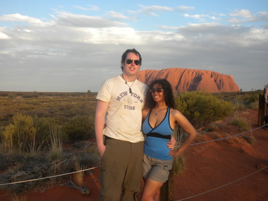
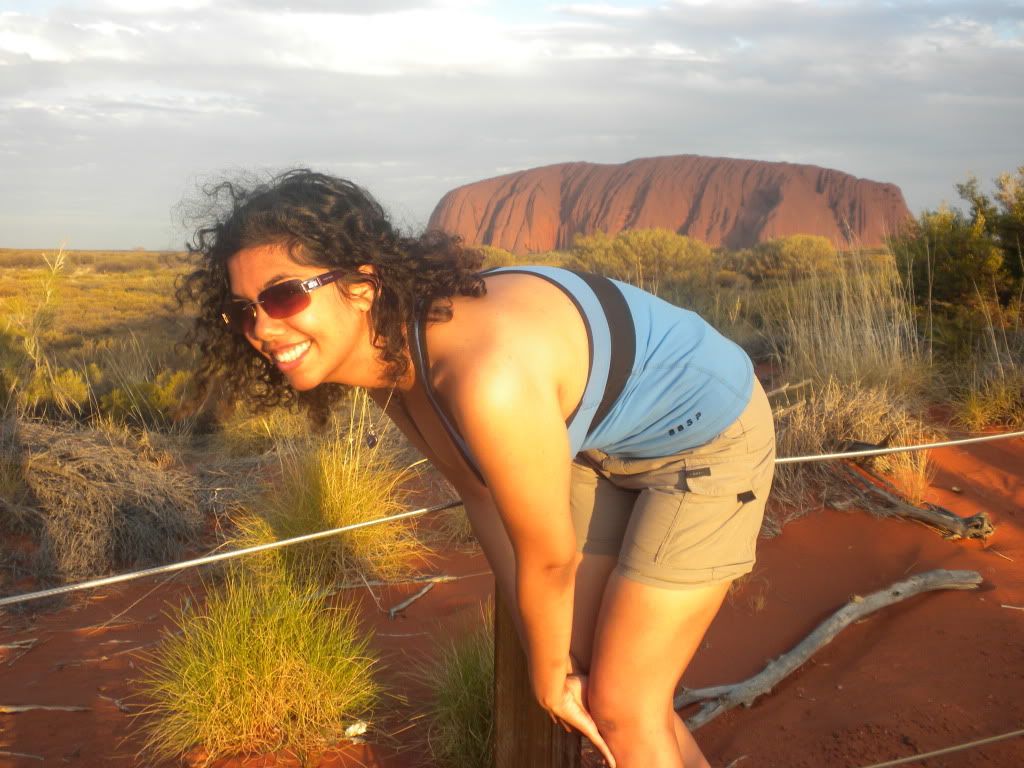
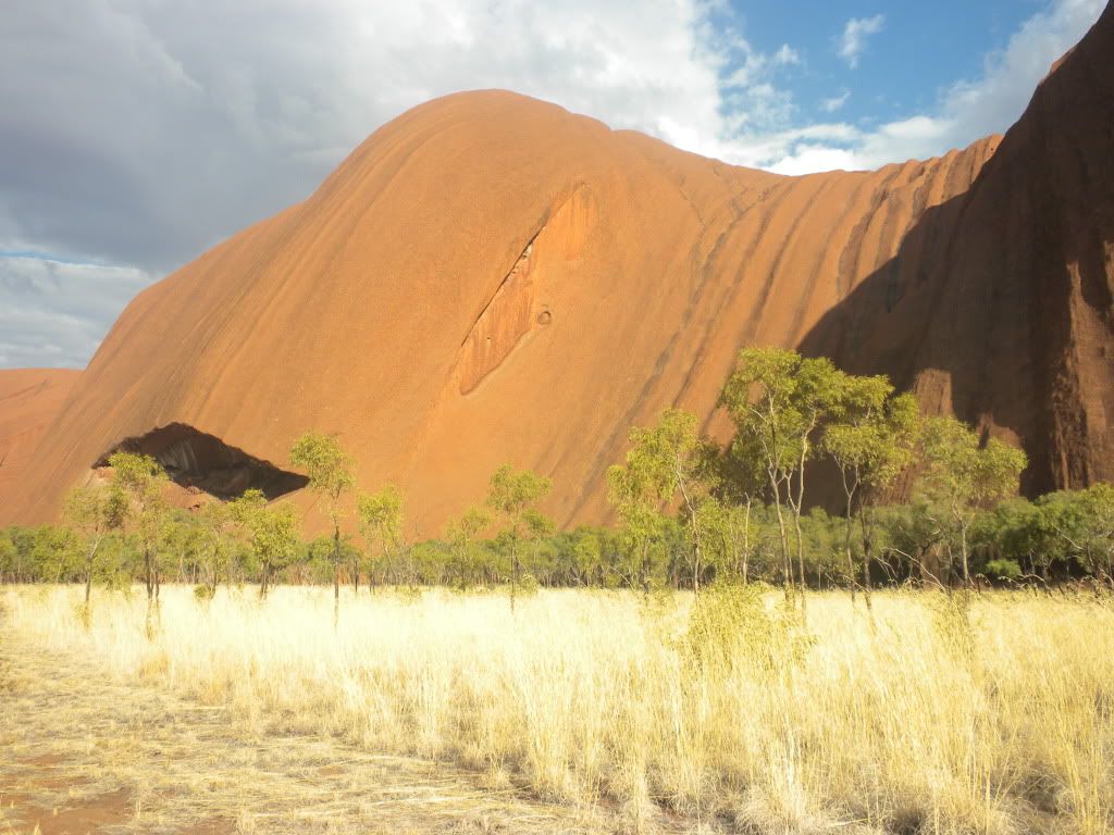
That evening we drove to Uluru for a sunset viewing. Henk attempted to get some pictures of Uluru sitting on top of my back, but I’m not quite sure those turned out as well as he hoped. Since it was cloudy, Uluru wasn’t glowing as red as we were promised – didn’t make for the greatest pictures, so we mostly enjoyed the crackers, cheese spreads, and champagne offered to us by the tour company and took pictures of Kata Tjuta in the distance instead. We were driven to camp, an almost identical camp to our previous night’s camp, and Lisa cooked up some chicken stir-fry and fruit custard for dinner.


Our wake-up call the next morning was before 5 am for an Uluru sunrise. However, it was still cloudy from the night before and raining a little bit. We were grateful we saw the rock in its full red-sand splendor the morning we flew in, because a cloudy sunrise was just about as anti-climatic as a cloudy sunset! That didn’t matter much to us though, we were just eager to go see the rock up close. At this point we had a choice to make: climb, or not climb Uluru?


Wiki explains why this was an important decision: “The local Anangu do not climb Uluru because of its great spiritual significance. They request that visitors do not climb the rock, partly due to the path crossing a sacred traditional Dreamtime track, and also due to a sense of responsibility for the safety of visitors to their land. The Anangu believe they have a spiritual connection to Uluru, and feel great sadness when a person dies (flogging themselves) or is injured whilst climbing… 35 people died since 1985 and many more before that trying to climb Uluru.”
Yikes! That’s a lot of things weighing the “not climb” choice. After all, it is basically akin to an Aboriginal “Mecca” or a high Cathedral. However, because of the rain that morning, the climb was closed at the time we were supposed to make a decision. But I highly doubt (especially after seeing the climb later in the day) the combined risk of death and disrespect to the Anangu would have been worth climbing Uluru. Lisa drove our group to the start of the Uluru base walk, and we got our cameras ready for some close photos of strange rock formations and ancient Aboriginal rock art. But we were told to wait!


Lisa explained that we were only allowed to take pictures in the areas which were not marked as an “Aboriginal Sacred Site” by a sign in front of them. These “no photography” areas are the sites of gender-linked rituals, and are forbidden ground for Anangu of the opposite sex of those participating in the rituals in question— they are not even allowed to look at each other’s sites! Lisa told us that an Aboriginal man was reading an article in a magazine when he went to the dentist one morning on Uluru, and ended up seeing a picture of one of the Women’s Sacred Uluru sites. This incident caused great uproar in the Aboriginal community, and led to the photography ban of sacred sites.


Tourists however, are okay to check out the sacred sites (regardless of gender) from a distance, since they are considered visitors by the local Aboriginals. We are seen as children and therefore we can still visit all these cool spots. Henk and I also found out that this is the reason we were not able to find much information about their myths and legends. The only stories we are allowed to hear, and that have been shared with non-Aboriginals are stories told to educate children. Much of the lore has been kept secret, and will most probably never be shared. Perhaps for the better…
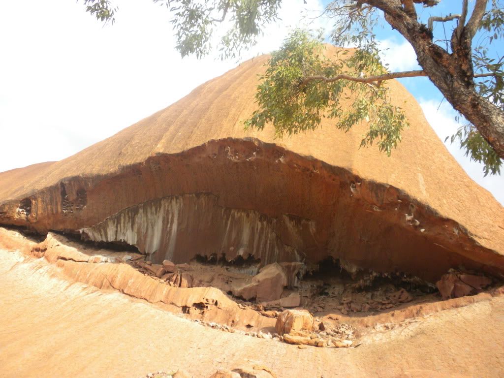
Henk and I took our time walking along the base of Uluru, admiring the formations. Some of them were huge! The shapes were obviously exceptional and unusual, and it is not puzzling that the Anangu could find special meanings and stories in them. One of those stories that we were allowed to hear was a children’s story of an Aboriginal woman:
The Kuniya woman came from far away in the east to hatch her children at Uluru. She carried her eggs strung around her neck like a necklace and brought them to rest at Kuniya Pita (one of the sacred sites at Uluru) on Uluru’s north-east corner. There she left the eggs on the ground. Kuniya camped at Taputji and hunted in the nearby sandhills. As she left and entered her camp she formed deep grooves into the rock. These grooves are still there. One day Kuniya had to draw on all her physical and magical powers to avenge the death of her young nephew, also a Kuniya and sometimes called Kuniyawati. He enraged a group of Liru, or poisonous snakes, who traveled from the south-west to take revenge on him. The Liru saw him resting at the base of Uluru and rushed upon him, hurling their spears. Many spears hit the rock face with such force that they pierced it, leaving a series of round holes which are still obvious on the west side of Uluru. The poor Kuniyawati, outnumbered, dodged what he could but eventually fell dead.
When the news of the young python’s dead reached his aunt on the other side of Uluru, she was overcome with grief and anger. She raced along the curves of the rock to Mutitjulu waterhole, where she confronted one of the Liru warriors, who mocked her grief and rage. Kuniya began a dance of immense power and magic. As she moved towards the Liru warrior she scooped up sand and rubbed it over her body. Her rage was so great that it spread like a poison, saturating the area at the time. In a fearsome dance, Kuniya took up her wana, or digging stick, and struck the head of the Liru hard enough to draw blood in a ‘sorry cut’ of the kind that Anangu still use in times of mourning and grief. But her anger was now beyond restraint, and she hit him again across the head. He fell dead, dropping his shield near the so-called hunter’s cave. Signs of this terrible conflict are still on the rocks around Mutitjulu waterhole. Kuniya herself remains a sinuous black line on the eastern wall. The blows she struck are two deep cracks on the western wall. The Liru’s shield lies where it fell, now a large boulder.


Henk and I continued walking until about halfway around the base of Uluru until we reached the sacred water hole from the story above. Remember the great ancestral snake Wanampi who lived on Kata Tjuta? The Mutitjulu waterhole is another home on that snake.

Around the corner from the waterhole was the first display of Aboriginal rock art – art that was tens of thousands of years old. And we were allowed to take pictures! Awesome. Aboriginals used the rocks not really as painting palette, but more like a message board. They left information for each other about water holes, food, and other resources on very basic maps. This is why some message “art” is layered on top of previous art. We read on the signs posted next to the art that the abstract symbols illustrate stories in the everyday lives of each generation of Anangu, each symbol containing different levels of meaning. Here are some of the symbols you can identify in our pictures of the rock art:


Anyways, after the rock art we were pretty much done with the entire base walk. On our way back to the bus, we saw that the climbing area of Uluru had been opened up and people were attempting to balance themselves on the face of the smooth rock using only a rope as aid. It did look really dangerous – and it didn’t even look like you’d get a great view if you did make it to the top. You would get a view of… the car park below? That would definitely not be worth breaking the Anangu’s request to not climb!


We hopped back on the bus and enjoyed some fruit cake Lisa had cut up for us. We made a quick drive to a nearby Aboriginal Cultural Centre (where sadly, we weren’t allowed to take pictures) and walked around for about 30 minutes, learning a bit more about the local people. Henk and I read through an “I’m Sorry” book, where people wrote letters to the Aboriginals apologizing for taking rocks from Uluru and for climbing Uluru in the 1980’s. Lisa spoke to us outside the center for a few minutes after, giving us the short scientific summery about Uluru that I explained earlier in the post, and then we got back on the bus. After paying our park fees, Henk and I were dropped back off at the resort to await our free shuttle to the airport. We were on our way to Perth! Our last stop in Australia: the West Coast!
Bye Everyone!
Francesca
