Francesca and Henk-Jan's Backpacking Trip!
Wednesday, August 19, 2009
The Southern Blood Runs Through Our Veins
Perhaps you were thinking we had disappeared off the face of the earth? Not entirely untrue! We have seen most of the rugged South of New Zealand now, taking in some breathtaking views in the most untouched part of the country. Obviously, we had no time to do a lot of writing, or generally just no internet/reception available.
We had set the alarm for 5:30AM on the 13th of August, because we were going to leave Queenstown behind us for some days. Not a good time to wake up, and an even worse time to be sitting on the bus. Francesca and I made it out in time and managed to get on the bus safe and sound. The driver didn’t say or ask much during the first stint, leaving us to get some more sleep.
Around 8:30AM he woke us up and told us his name: Rob. Rob was one of two drivers that had opted to only do the circle south of Queenstown; all the others do the full circuit around New Zealand. The bus was much smaller than the ones we had been traveling on, and we had a small group of 7 people. To be honest, this was a much nicer experience as we could talk to the driver and some of our fellow passengers a bit more.
Rob drove us towards Te Anau, stopping just short of the city centre to show us Te Anau Downs. This place is known as the start of the famous Milford Track, a hike known as one of the most stunning multiple day hikes in the world. Where did we hear that before? In fact, the whole area is littered with renowned walks, the most notable ones being the Routburn, the Hollyford and the Milford Track. However, both were closed/unwise to hike due to unsafe conditions. No Milford Track for me…
Te Anau offered us a welcome stop for some groceries and breakfast. We also purchased tickets for a Milford Sound Cruise and a return ticket to Stewart Island. Leaving the civilized world behind was a good choice though, because the scenery we ended up driving through was absolutely gorgeous. The landscape is cloaked in cool temperate rainforest, jungle-dense and complete with vines, climbers, perching plants and ferns, including fern trees.
We learned a valuable lesson, because we thought the fern trees were palm trees… Fern trees aren’t really trees. As they grow their older leaves die off, but don’t fall off. The fern keeps growing on top of its remains, looking like a diseased tree. Interesting!
The park we had entered, Fiordland National Park is one of the wettest places in the world, with Milford Sound averaging more than 6 meters of rain per year. In winter conditions get worse, as rain turns into snow. In fact, we had been quite lucky, because the Milford Road had been closed for several weeks due to avalanches. Our driver told us that this day was the first the Road had been opened to public again. On top of that, the weather had turned out to be gorgeous. No clouds, no rain…
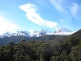
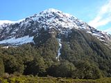
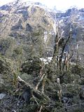
Rob stopped several times along the way, allowing us to get some pictures of the snow-topped mountains. We saw the damage the avalanches had done, and it was quite something. Rob explained how most of the damage is not actually caused by the falling snow, but by the wind being pushed down by the snow, creating an explosive air blast and winds up to 200 kilometers per hour. In some places it looked like huge trees had snapped like toothpicks, and then covered in snow. I wanted to jump out and get some pictures, but this was not allowed.
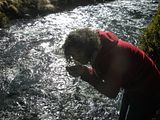
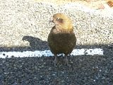
Our next stop was Monkey Creek, with a view of the Upper Hollyford and Darren Mountains. We tried the clear water coming down through the creek, and it tasted better than any bottled water. Rob also pointed out a kea, a very noisy and nosy mountain parrot that’s not afraid of humans at all. The kea is the world’s only alpine parrot, confined to the mountain areas of New Zealand’s South Island. Raucous cries of ‘keeea’ often give away the presence of these highly social and inquisitive birds. They are quite famous for stealing lunches, and other human possessions, and are even known to eat rubber out of cars.
As we drove further into the Park the terrain around us became more and more rugged, and we saw more and more snow. Sometimes it would tower over our little bus on both sides of the road. Quite spooky to think that that much snow came down just a few weeks before us, and it was no wonder there were signs saying we weren’t allowed to stop anywhere!
In such a mountainous area it’s no wonder roads sometimes became hard to build. Instead of going over, in one instance the pioneers had to go under. Rob drove us through a tunnel called the Homer Tunnel. Work on the tunnel started in 1935, but was not completed until 1953. The tunnel is still very rugged and uneven, because the workers back then did not have the tools of today. Water can be seen and heard dripping through constantly.
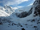
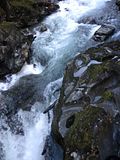
As the bus exited the tunnel we saw people working on clearing the roads. Apparently, they had set off some charges on one side of the mountain to create an artificial avalanche. Crazy amounts of snow covered the valleys beneath us. Rob stopped at a place called the ‘Chasm’ and Francesca and I did the short 15 minute walk. The pathway led up to a viewpoint with some amazing rock formations in the river. The force of water and rocks swirling and grinding in the currents created the sculpted rocks and rounded basins of the Chasm.
Around 13:00PM we finally arrived at Milford Sound. Exploring the rugged coastline in 1770, Captain James Cook did not enter Milford Sound, believing nothing lay beyond what looked like an unlikely entrance. It took another 25 years before a European whaler named John Grono, born near Milford Haven in Wales, found and (mis)named the Sound. Permanent European settlement began in the late 1970s with Scotsman Donald Sutherland’s establishment of the ‘City of Milford.’ Sutherland explored the area extensively and found New Zealand highest waterfalls, the Sutherland Falls. He claimed they were the highest in the world with 1000 meters of falling water. Tourism soared, even after Sutherland’s claim was disproved as the Falls were measured at some 660 meters.
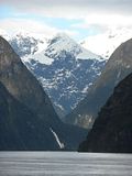
While known as Milford Sound, the correct name for these waterways is ‘fiord.’ A fiord is an ice-carved valley – typically narrow and steep-sided – that has been flooded by the sea after the glacier’s retreat. A ‘sound’ in contrast is a river valley flooded by the sea following a rise in sea levels or depression of the land. The name was never changed, however.
Yet in Maori legend, the fiords were created not by rivers of ice, but by Te Te Raki Whanoa, a godly figure who came wielding a magical adze and uttering incantations. Milford Sound (Piopiotahi) was his last and finest sculpture.
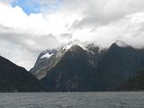
Rob took us to the boat for our scenic cruise of the Sound. The skipper told us stories of the surrounding viewpoints as he took us around the Sound. The first notable stop was Mitre Peak, so named because its resemblance to a Bishop’s Mitre. This mountain is believed to be one of the world’s highest mountains to rise directly out of the sea, being 1682 meters high.
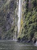
Francesca and I also saw 2 great waterfalls; Bowen Falls and Stirling Falls, being 160 and 155 meters in height respectively. The skipper took us right under the falls, causing some people to run, and others to get wet, as they got covered in the spray.
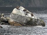
On the way back through the fiord we also stumbled upon some New Zealand Fur Seals, basking in the sun. Unfortunately, we did not see any other wildlife. The water running down the mountains, being fresh, creates a layer on top of the salty sea water. Since rain and snow had been abundant, this layer had become rather thick, and prevented animals like penguins, dolphins and the occasional whale from showing up during our cruise.
Our relaxing trip came to an end and Rob dragged us back to the orange monster. Stray used to go all the way back to Te Anau for an overnight stop, but luckily for us they thought that this was too much travel, and decided to stop at Gunn’s Camp in the Hollyford Valley, pretty close to Milford Sound. This meant we had some time on the way back to stop to take some snapshots. I got a cool shot of Rob eyeballing (or being eyeballed by) a kea, and some awesome pictures of damage done by avalanches.
Before Rob took us to Gunn’s Camp he had us walk to Lake Marian. Francesca and I slowly crossed a wobbly bridge and hiked up the track. The name proved to be quite deceptive, as all we saw was a river. We agreed that the amount of falling, dripping and streaming water was getting to be too much, so we turned back and drove off to the Camp.
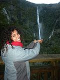
Rob wasn’t quite done with us, as he gave the option to check out Humboldt Falls. Even though we were both tired, Francesca and I still wanted to see it and headed out with Rob and Jen, a Canadian girl on our bus. The walk proved to be worth it, as we got some great pictures. I got Francesca to pose in two original ways. Tired, but satisfied Rob took us back to our cabins.
Gunn’s Camp was called after Davie Gunn, a pioneer that set up camp in the very same spot we were staying. He was quite famous for being a tracker, and showed heroism by saving some people that crashed with a plane. Gunn unfortunately died at 68, drowning in a river. He left his legacy though, naming about everything in the region after himself. The place is pretty much called Gunn’s Country.
The cabin we stayed in was not heated, and covered in sandflies. Francesca set about murdering these and drenching our bed in Deet, whilst I made us a meal. Since the day had been so long we fell asleep quite early. Our sleep was one of the best in a long time, as it was pitch dark after 22:00PM (the power went off at this hour) and there was not a sound outside.
We were quite happy to leave Gunn’s Camp behind, as sandflies are not our kind of wildlife. Around 08:30AM Rob started up the bus and off we went.
The drive today would take us to Bluff, where we were to jump off the bus to check out Stewart Island, the anchor stone from Maui’s canoe. First we had to get there though! Leaving Milford Sound and snow behind us, we entered a completely different landscape. Rugged ranges were exchanged for gentle grasslands with grazing sheep. Since the whole day would look like this, Rob introduced us to the tractor-game: spot a tractor and shout out its color for 1 point; spot a working tractor and shout out ‘tractor working’ for 5 points; and 3 or more tractors together for a ‘tractor dealership’ and 5 points. He also added 3 animal-related points: ‘knock ‘m out’ for 2 fighting animals worth 5 points; ‘little lamb’ for a sheep giving birth (highly unlikely!) for 10 points; and ‘sexy animals’ for 2 animals getting it on worth a mere 10 points.
Rob challenged the rest of the bus to a duel with some drinks to be won. Unfortunately, only Francesca and I joined in, peering into the distance, looking for tractors (only after I explained to her what they looked like) and keeping track of our points. Francesca got to shout out ‘sexy animals’ twice, so we scored quite a lot of points and in fact managed to beat our driver. Shame he didn’t come with us to Stewart Island, so we didn’t get our drinks in the end…
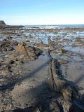
Before we got there though, we made a lunch stop at Curio Bay. Supposedly a good spot for spotting sea lions… I think I saw one, but I’m not wholly sure. Lunch consisted of roasted chicken sandwiches and juice, so especially Francesca loved it. After finishing our food, Francesca and I wandered off to the other side of the bay, which seemed much more interesting to us. That part of the bay was home to a ‘Petrified Forest:’ a forest that grew about 160 million years ago, which got killed by being buried under a flood of ash from a volcanic eruption. As time went by the land was engulfed by the sea, which slowly revealed the broken logs and the stumps still in the original position of growth.
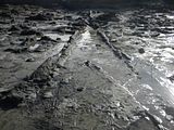
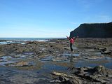
We were unsure why Rob didn’t take us there, but we were quite happy to check the Forest out by ourselves. In fact, it was the best part of the day. We didn’t get to see the colony of the rare yellow-eyed penguins, which was supposed to be around. Apparently, they can only be seen in the early morning, when the tide is high and their natural predators chase them off to the coastline.
The final part of the trip with Rob took us to Bluff, where we said goodbye to him and most of the bus. Only one other person came with us: Jen, the Canadian girl. The ferry over took a good hour and was quite comfortable. Stewart Island proved to be a good spot for us to relax and sit back. The island and its only city Oban, is so quiet, and there was so little to do, that we felt completely comfortable just loafing around in and around the hostel. The most notable evening was the Sunday, when we went to the South Sea Hotel for Sunday Roast and a pub quiz. The roast tasted awesome, but the locals defeated, nay crushed our team as our knowledge of New Zealand history and random quirky facts proved to be insufficient.
After staying 4 full days on Stewart Island Francesca and I felt quite revived and rejuvenated, so we decided to leave Oban and ‘Stewie’ behind, and check out the remainder of the rugged south. We hopped back on the ferry in the afternoon and made it back to Bluff around 15:30PM.
